IMAGES TAKEN NEAR TO
Lind Road, GOSPORT, PO12 2UL
Introduction
This page details the photographs taken nearby to Lind Road, PO12 2UL by members of the Geograph project.
The Geograph project started in 2005 with the aim of publishing, organising and preserving representative images for every square kilometre of Great Britain, Ireland and the Isle of Man.

There are currently over 7.5m images from over14,400 individuals and you can help contribute to the project by visiting https://www.geograph.org.uk
Image Map
Images are licensed for reuse under creativecommons.org/licenses/by-sa/2.0
Notes
- Clicking on the map will re-center to the selected point.
- The higher the marker number, the further away the image location is from the centre of the postcode.
Image Listing (224 Images Found)
Images are licensed for reuse under creativecommons.org/licenses/by-sa/2.0
Image
Details
Distance
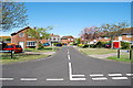
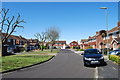
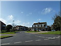
2
A contrasting walk around Clayhall (12)
Sandwiched either side of a trip to Fort Blockhouse, it was inclement before and gloriously sunny after. This is in Spithead Avenue.
Image: © Basher Eyre
Taken: 3 Mar 2012
0.03 miles
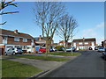
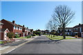
3
A contrasting walk around Clayhall (15)
Sandwiched either side of a trip to Fort Blockhouse, it was inclement before and gloriously sunny after. This is a bend in Spithead Avenue.
Image: © Basher Eyre
Taken: 3 Mar 2012
0.03 miles
4
A contrasting walk around Clayhall (16)
Sandwiched either side of a trip to Fort Blockhouse, it was inclement before and gloriously sunny after. This is looking from Spithead Avenue into Gilkicker Road.
Image: © Basher Eyre
Taken: 3 Mar 2012
0.04 miles
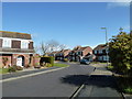
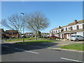
6
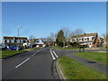
A contrasting walk around Clayhall (18)
Sandwiched either side of a trip to Fort Blockhouse, it was inclement before and gloriously sunny after. This is in Gilkicker Road, approaching Lind Road.
Image: © Basher Eyre
Taken: 3 Mar 2012
0.04 miles
9
A contrasting walk around Clayhall (17)
Sandwiched either side of a trip to Fort Blockhouse, it was inclement before and gloriously sunny after. This is in Gilkicker Road, looking into Longwater Drive.
Image: © Basher Eyre
Taken: 3 Mar 2012
0.05 miles
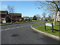
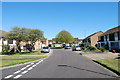
10
A contrasting walk around Clayhall (14)
Sandwiched either side of a trip to Fort Blockhouse, it was inclement before and gloriously sunny after. This is at the junction of Spithead Avenue and Gilkicker Road.
Image: © Basher Eyre
Taken: 3 Mar 2012
0.05 miles