IMAGES TAKEN NEAR TO
Hartland Court, EMSWORTH, PO10 8LP
Introduction
This page details the photographs taken nearby to Hartland Court, PO10 8LP by members of the Geograph project.
The Geograph project started in 2005 with the aim of publishing, organising and preserving representative images for every square kilometre of Great Britain, Ireland and the Isle of Man.

There are currently over 7.5m images from over14,400 individuals and you can help contribute to the project by visiting https://www.geograph.org.uk
Image Map
Images are licensed for reuse under creativecommons.org/licenses/by-sa/2.0
Notes
- Clicking on the map will re-center to the selected point.
- The higher the marker number, the further away the image location is from the centre of the postcode.
Image Listing (155 Images Found)
Images are licensed for reuse under creativecommons.org/licenses/by-sa/2.0
Image
Details
Distance
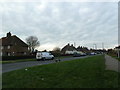
6
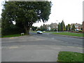
Junction of Hartland Court and Stein Road
Image: © Basher Eyre
Taken: 27 Nov 2010
0.04 miles
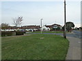
7
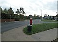
Postbox at the junction of Stein and Manor Roads
Image: © Basher Eyre
Taken: 27 Nov 2010
0.04 miles
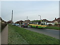
8
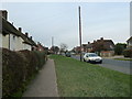
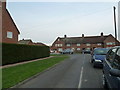
Stein Road, Southbourne
Heading south.
Image: © Robin Webster
Taken: 10 Jun 2018
0.05 miles
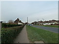
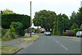
10
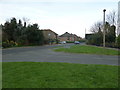
Looking from Stein Road into Kelsey Avenue
Image: © Basher Eyre
Taken: 27 Nov 2010
0.05 miles