IMAGES TAKEN NEAR TO
Lumley Road, EMSWORTH, PO10 8AF
Introduction
This page details the photographs taken nearby to Lumley Road, PO10 8AF by members of the Geograph project.
The Geograph project started in 2005 with the aim of publishing, organising and preserving representative images for every square kilometre of Great Britain, Ireland and the Isle of Man.

There are currently over 7.5m images from over14,400 individuals and you can help contribute to the project by visiting https://www.geograph.org.uk
Image Map
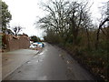
Images are licensed for reuse under creativecommons.org/licenses/by-sa/2.0
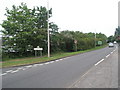
Notes
- Clicking on the map will re-center to the selected point.
- The higher the marker number, the further away the image location is from the centre of the postcode.
Image Listing (421 Images Found)
Images are licensed for reuse under creativecommons.org/licenses/by-sa/2.0
Image
Details
Distance
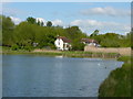
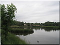
5
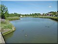
Hermitage, mill pond
The northern section of Slipper Millpond, once serving a mill to the South. Tidal, and a lagoon.
Image: © Mike Faherty
Taken: 22 Jun 2019
0.07 miles
7
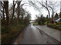
Lumley Road
Lumley Road just after The Rookery, it's changed a lot from May 2011 (see Google Street View).
Image: © Hamish Griffin
Taken: 29 Jan 2015
0.08 miles
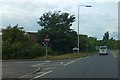
8
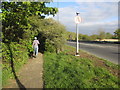
Dog walker adjacent to A259
Public footpath 245/2 to Hermitage.
Image: © Peter Holmes
Taken: 19 Apr 2014
0.08 miles
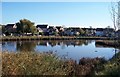
9
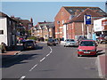
Queen Street - viewed from Hermitage Bridge
Image: © Betty Longbottom
Taken: 15 Apr 2015
0.08 miles