IMAGES TAKEN NEAR TO
Vinery Lane, PLYMOUTH, PL9 8DE
Introduction
This page details the photographs taken nearby to Vinery Lane, PL9 8DE by members of the Geograph project.
The Geograph project started in 2005 with the aim of publishing, organising and preserving representative images for every square kilometre of Great Britain, Ireland and the Isle of Man.

There are currently over 7.5m images from over14,400 individuals and you can help contribute to the project by visiting https://www.geograph.org.uk
Image Map
Images are licensed for reuse under creativecommons.org/licenses/by-sa/2.0
Notes
- Clicking on the map will re-center to the selected point.
- The higher the marker number, the further away the image location is from the centre of the postcode.
Image Listing (14 Images Found)
Images are licensed for reuse under creativecommons.org/licenses/by-sa/2.0
Image
Details
Distance
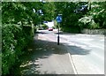
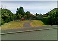
2
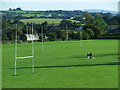
King George V's Playing Fields, Elburton
These playing fields were left to the people of the parish, under covenant, to be preserved as a 'leisure area', in perpetuity.
Image: © Gwyn Jones
Taken: 4 Oct 2005
0.07 miles
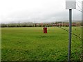
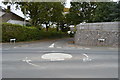
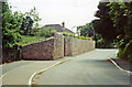
6
Play area off Candish Drive, Plymouth
Image: © Alex McGregor
Taken: 14 Jun 2011
0.15 miles
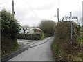
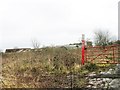
7
Site of former Elburton Cross station, 1991
View northward past abutments of the former bridge of the ex-GWR Plymouth (to right) - Yealmpton (to left) branch, the station having been on the left. This branch had been closed to passengers back in July 1930, but during World War Two it was reopened for people displaced by the terrible 1941 Blitz on Plymouth, albeit with a service from Plymouth Friary (SR), from 21/7/41 until 6/10/47 and it remained open for goods until 29/7/60.
Image: © Ben Brooksbank
Taken: 9 Jun 1991
0.18 miles