IMAGES TAKEN NEAR TO
Spring Road, PLYMOUTH, PL9 0AX
Introduction
This page details the photographs taken nearby to Spring Road, PL9 0AX by members of the Geograph project.
The Geograph project started in 2005 with the aim of publishing, organising and preserving representative images for every square kilometre of Great Britain, Ireland and the Isle of Man.

There are currently over 7.5m images from over14,400 individuals and you can help contribute to the project by visiting https://www.geograph.org.uk
Image Map
Images are licensed for reuse under creativecommons.org/licenses/by-sa/2.0
Notes
- Clicking on the map will re-center to the selected point.
- The higher the marker number, the further away the image location is from the centre of the postcode.
Image Listing (6 Images Found)
Images are licensed for reuse under creativecommons.org/licenses/by-sa/2.0
Image
Details
Distance
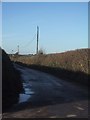
4

South Hams : Farm Track
A track heading off the road near Heybrook Bay.
Image: © Lewis Clarke
Taken: 25 Jul 2012
0.17 miles
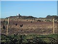
5
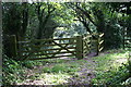
Gate at the top of the Path
This path leads down the coastal slope to the coast near Wembury Point. When the nearby naval gunnery training school, HMS Cambridge, was in operation (it closed in 2001) and conducting firing exercises the coast path beneath the guns was closed and walkers would have to take this path as part of a lengthy and energetic diversion.
Image: © Tony Atkin
Taken: 26 Jul 2008
0.19 miles
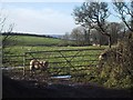
6
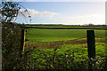
Farmland at Gabber Farm
Pasture on a gently rising hillside.
Image: © Kate Jewell
Taken: 1 Jan 2013
0.25 miles