IMAGES TAKEN NEAR TO
Barbican Road, PLYMOUTH, PL7 1LX

Introduction

This page details the photographs taken nearby to Barbican Road, PL7 1LX by members of the Geograph project.

The Geograph project started in 2005 with the aim of publishing, organising and preserving representative images for every square kilometre of Great Britain, Ireland and the Isle of Man.

There are currently over 7.5m images from over14,400 individuals and you can help contribute to the project by visiting https://www.geograph.org.uk

Image Map


Images are licensed for reuse under creativecommons.org/licenses/by-sa/2.0
Notes
  • Clicking on the map will re-center to the selected point.
  • The higher the marker number, the further away the image location is from the centre of the postcode.

Image Listing (176 Images Found)

Images are licensed for reuse under creativecommons.org/licenses/by-sa/2.0
  • ...
Image
Details
Distance
1
St Maurice Auto
Image: © N Chadwick Taken: 31 May 2018
0.01 miles
2
The Old Castle Inn
Image: © N Chadwick Taken: 31 May 2018
0.02 miles
3
Castle Cottage (Cott)
The photographer's father (Arthur Edward Vosper) was born in this house in 1913 when it was known by the family as "Castle Cott". Located so close to the base of the castle mound it was aptly named. Information passed down through the family, mentions that the house was bought by the photographer's grandfather for £300 and the extension, which included a bathroom facility and which is clearly shown here in this photo, was added later at a cost of £60. Image
Image: © Colin Vosper Taken: 10 Mar 2010
0.02 miles
4
Castle Cottage
Castle View, as it was called in the 1920s, was probably carefully named before the trees grew up and when it had a good view of Plympton's 12th century Motte and Bailey Castle. Over the years the house name has been changed firstly to Castle Cott and in recent year it has been renamed as Castle Cottage. (The second such name locally.) This photo shows the winter time view from the top of Plympton Castle when it is only just visible through the bare branches of the trees, but in the summer months it is never in view from the top of the castle when the trees are in full leaf. Image
Image: © Colin Vosper Taken: 10 Mar 2010
0.02 miles
5
Castle Vicinity, Plympton St Maurice, Devon
The motte and ruins of the castle from School Road.
Image: © David Hallam-Jones Taken: 18 Aug 2018
0.03 miles
6
War Memorial, Plympton St Maurice
Image: © N Chadwick Taken: 31 May 2018
0.03 miles
7
1, 2, George Lane
Grade II listed. http://www.britishlistedbuildings.co.uk/101322034-1-and-2-george-lane-plympton-erle-ward
Image: © N Chadwick Taken: 3 Dec 2016
0.04 miles
8
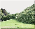
Castle Vicinity, Plympton St Maurice, Devon
The start of the spiral path encircling the motte (mound) upon which the ruins of the castle remain. To the left of the litter bin is a public car park accessible from Barbican Road.
Image: © David Hallam-Jones Taken: 18 Aug 2018
0.04 miles
9
Parish Church, Plympton St Maurice, Devon
A view from the spiralling path that encircles the castle ruins. To the right of the church, on George Lane, is the former Hele's (pronounced "heals") School site. The Grade II* listed Jacobean Gothic building was founded as Plympton Grammar School c.1660 as the result of a bequest of a lawyer Elize Hele. In 1715 the Rev Samuel Reynolds was appointed as head master and his son, the painter Sir Joshua Reynolds, (1723-92) attended the school. In 1937 the school moved to new premises on Seymour Road, which it still occupies today, This newer school was renamed "Hele's School" when it became a state comprehensive in 1985.
Image: © David Hallam-Jones Taken: 18 Aug 2018
0.04 miles
10
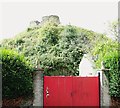
Plympton Castle
Image: © N Chadwick Taken: 31 May 2018
0.04 miles
  • ...