IMAGES TAKEN NEAR TO
Cornwood Road, PLYMOUTH, PL7 1AL
Introduction
This page details the photographs taken nearby to Cornwood Road, PL7 1AL by members of the Geograph project.
The Geograph project started in 2005 with the aim of publishing, organising and preserving representative images for every square kilometre of Great Britain, Ireland and the Isle of Man.

There are currently over 7.5m images from over14,400 individuals and you can help contribute to the project by visiting https://www.geograph.org.uk
Image Map
Images are licensed for reuse under creativecommons.org/licenses/by-sa/2.0
Notes
- Clicking on the map will re-center to the selected point.
- The higher the marker number, the further away the image location is from the centre of the postcode.
Image Listing (20 Images Found)
Images are licensed for reuse under creativecommons.org/licenses/by-sa/2.0
Image
Details
Distance
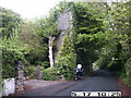
1
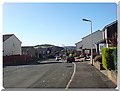
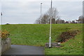
Greenacres, Cornwood Road, Plympton
Cornwood Road was doubtless the road into town from Cornwood; now it is a no through road, truncated by the B3418 Sandy Road - see also Image
On the right is the entrance to Greenacres, a stretch of access woodland managed by the Woodland Trust. "Greenacres is a part of a small, level, mature woodland retained during development of the surrounding residential area. It is stocked with mainly stored sycamore coppice, with a number of mature oak, ash, sweet chestnut and a small number of large beeches scattered throughout. Dense areas of laurel under storey have been recently cleared. The shading from the sycamore and laurel has largely reduced the ground flora levels." http://www.woodlandtrust.org.uk/en/our-woods/ourwoodsmanagementplans/parkway-woods-management-plan.pdf / http://www.woodlandtrust.org.uk/en/our-woods/Pages/about-this-wood.aspx?wood=4399
Image: © Derek Harper
Taken: 10 Dec 2009
0.05 miles
2
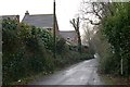
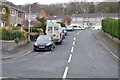
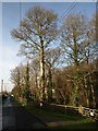
The Old Cornwood Road, Plympton
This section of country lane has been left untouched, even though it has now been completely surrounded by suburban housing.
Image: © Tony Atkin
Taken: 8 Jan 2006
0.06 miles
3
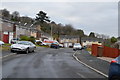
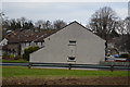
The Triangular Folly House
This listed Folly is easily missed and is on the garden boundary of 'Folly Cottage'
Image: © Graham Flint
Taken: 17 May 2006
0.12 miles
4
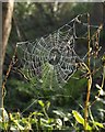
Spider's web, Greenacres
This web is close to the western entrance to Greenacres (see Image) on The Spinney.
Image: © Derek Harper
Taken: 10 Dec 2009
0.14 miles