IMAGES TAKEN NEAR TO
Croft Park, PLYMOUTH, PL6 7QJ
Introduction
This page details the photographs taken nearby to Croft Park, PL6 7QJ by members of the Geograph project.
The Geograph project started in 2005 with the aim of publishing, organising and preserving representative images for every square kilometre of Great Britain, Ireland and the Isle of Man.

There are currently over 7.5m images from over14,400 individuals and you can help contribute to the project by visiting https://www.geograph.org.uk
Image Map
Images are licensed for reuse under creativecommons.org/licenses/by-sa/2.0
Notes
- Clicking on the map will re-center to the selected point.
- The higher the marker number, the further away the image location is from the centre of the postcode.
Image Listing (32 Images Found)
Images are licensed for reuse under creativecommons.org/licenses/by-sa/2.0
Image
Details
Distance
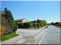
1
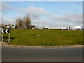
Woolwell Road
Park in Tesco car park then jump on the grassy roundabout.
Name: Woolwell Road
Hill number: 5529
Height: 162m / 531ft
Area: 40: Cornwall & Devon
Class: CoU
Grid ref: SX 50469 61585
Summit feature: middle of roundabout between Tescos and the council offices
Drop: 0m
Col: 162m SX504615
Image: © Rude Health
Taken: 11 Mar 2012
0.05 miles