IMAGES TAKEN NEAR TO
Beverston Way, PLYMOUTH, PL6 7DY
Introduction
This page details the photographs taken nearby to Beverston Way, PL6 7DY by members of the Geograph project.
The Geograph project started in 2005 with the aim of publishing, organising and preserving representative images for every square kilometre of Great Britain, Ireland and the Isle of Man.

There are currently over 7.5m images from over14,400 individuals and you can help contribute to the project by visiting https://www.geograph.org.uk
Image Map
Images are licensed for reuse under creativecommons.org/licenses/by-sa/2.0
Notes
- Clicking on the map will re-center to the selected point.
- The higher the marker number, the further away the image location is from the centre of the postcode.
Image Listing (25 Images Found)
Images are licensed for reuse under creativecommons.org/licenses/by-sa/2.0
Image
Details
Distance
7
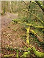
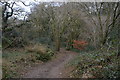
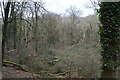
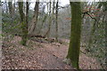
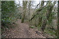
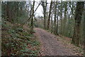
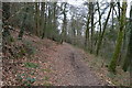
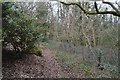
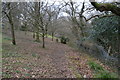
Path near Roborough
Signposted as a public footpath to Tamerton Foliot from the Belliver estate, this path descends a long wooded valley leading down to Tamerton Lake.
Image: © Derek Harper
Taken: 25 Feb 2010
0.19 miles