IMAGES TAKEN NEAR TO
Shipley Walk, PLYMOUTH, PL6 5LT
Introduction
This page details the photographs taken nearby to Shipley Walk, PL6 5LT by members of the Geograph project.
The Geograph project started in 2005 with the aim of publishing, organising and preserving representative images for every square kilometre of Great Britain, Ireland and the Isle of Man.

There are currently over 7.5m images from over14,400 individuals and you can help contribute to the project by visiting https://www.geograph.org.uk
Image Map
Images are licensed for reuse under creativecommons.org/licenses/by-sa/2.0
Notes
- Clicking on the map will re-center to the selected point.
- The higher the marker number, the further away the image location is from the centre of the postcode.
Image Listing (5 Images Found)
Images are licensed for reuse under creativecommons.org/licenses/by-sa/2.0
Image
Details
Distance
1

Plymouth Garden Centre
This is located at the former Bowden Battery.
Image: © Ruth Sharville
Taken: 28 Apr 2010
0.17 miles
2
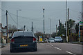
Plymouth : Fort Austin Avenue
Looking along Fort Austin Avenue.
Image: © Lewis Clarke
Taken: 17 Mar 2020
0.18 miles
3

Seasonal display at Plymouth Garden Centre
Autumn/winter colour plants to the fore.
Image: © Jonathan Billinger
Taken: 15 Oct 2014
0.20 miles
4

Plymouth Garden Centre
Built within the walls of the Bowden Battery.
Image: © Jonathan Billinger
Taken: 15 Oct 2014
0.20 miles
5
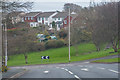
Plymouth : Fort Austin Avenue
Looking along Fort Austin Avenue.
Image: © Lewis Clarke
Taken: 17 Mar 2020
0.23 miles