IMAGES TAKEN NEAR TO
Budshead Road, PLYMOUTH, PL6 5DY
Introduction
This page details the photographs taken nearby to Budshead Road, PL6 5DY by members of the Geograph project.
The Geograph project started in 2005 with the aim of publishing, organising and preserving representative images for every square kilometre of Great Britain, Ireland and the Isle of Man.

There are currently over 7.5m images from over14,400 individuals and you can help contribute to the project by visiting https://www.geograph.org.uk
Image Map
Images are licensed for reuse under creativecommons.org/licenses/by-sa/2.0
Notes
- Clicking on the map will re-center to the selected point.
- The higher the marker number, the further away the image location is from the centre of the postcode.
Image Listing (71 Images Found)
Images are licensed for reuse under creativecommons.org/licenses/by-sa/2.0
Image
Details
Distance
1
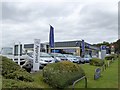
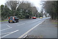
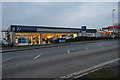
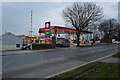
Car dealer and filling station, Crownhill
In Budshead Road, B3373
Image: © David Smith
Taken: 26 Sep 2014
0.03 miles
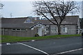
4
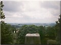
View from Crownhill Fort trig point, 1997
Showing the surface plate of the triangulation pillar and the view southwards over Plymouth.
Image: © E Gammie
Taken: 22 Jun 1997
0.05 miles
5
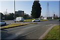
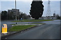
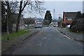
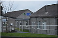
Budshead Roundabout
Behind and to the left is Crownhill police station
Image: © jeff collins
Taken: 13 Mar 2014
0.05 miles