IMAGES TAKEN NEAR TO
Warwick Avenue, PLYMOUTH, PL5 4BQ
Introduction
This page details the photographs taken nearby to Warwick Avenue, PL5 4BQ by members of the Geograph project.
The Geograph project started in 2005 with the aim of publishing, organising and preserving representative images for every square kilometre of Great Britain, Ireland and the Isle of Man.

There are currently over 7.5m images from over14,400 individuals and you can help contribute to the project by visiting https://www.geograph.org.uk
Image Map
Images are licensed for reuse under creativecommons.org/licenses/by-sa/2.0
Notes
- Clicking on the map will re-center to the selected point.
- The higher the marker number, the further away the image location is from the centre of the postcode.
Image Listing (27 Images Found)
Images are licensed for reuse under creativecommons.org/licenses/by-sa/2.0
Image
Details
Distance
1
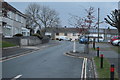
Warwick Avenue, Crownhill, Plymouth
One of a series of roads on this estate which are named after towns and cities in England
Image: © David Smith
Taken: 26 Sep 2014
0.04 miles
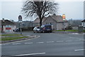
2
Bodmin Road, Whitleigh - Plymouth
The sign on the left is yet another that marks the spot of a derelict pub - The Tiger.
Image: © Mick Lobb
Taken: 8 Jul 2009
0.08 miles
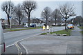
3
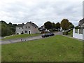
'Green Belt' between Berwick Avenue and Bodmin Road, Whitleigh - Plymouth
Image: © Mick Lobb
Taken: 8 Jul 2009
0.09 miles
4
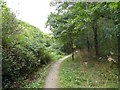
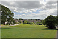
The Co-operative Way in Woodland Woods (1)
The Co-operative Way is a circular walk around the north of Plymouth. Here it runs through Woodland Woods, the name having been taken from the nearby Woodland Fort
Image: © David Smith
Taken: 26 Sep 2014
0.11 miles
6
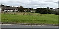
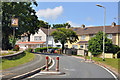
Berwick Avenue and open space, Crownhill, Plymouth
The open space separates two estates; in one, the roads are named after Scottish towns and cities (including Berwick), in the other, the names correspond to English ones. The tarmac in the foreground is Bodmin Road
Image: © David Smith
Taken: 26 Sep 2014
0.12 miles
8
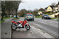
Taxi or Bike
Budshead Road looking towards Whitleigh from Crownhill
Image: © roger geach
Taken: 26 Nov 2012
0.13 miles
9
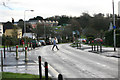
Crossing the road
Suburban road Whitleigh looking towards Crownhill
Image: © roger geach
Taken: 26 Nov 2012
0.13 miles