IMAGES TAKEN NEAR TO
Boniface Lane, PLYMOUTH, PL5 3AX
Introduction
This page details the photographs taken nearby to Boniface Lane, PL5 3AX by members of the Geograph project.
The Geograph project started in 2005 with the aim of publishing, organising and preserving representative images for every square kilometre of Great Britain, Ireland and the Isle of Man.

There are currently over 7.5m images from over14,400 individuals and you can help contribute to the project by visiting https://www.geograph.org.uk
Image Map
Images are licensed for reuse under creativecommons.org/licenses/by-sa/2.0
Notes
- Clicking on the map will re-center to the selected point.
- The higher the marker number, the further away the image location is from the centre of the postcode.
Image Listing (49 Images Found)
Images are licensed for reuse under creativecommons.org/licenses/by-sa/2.0
Image
Details
Distance
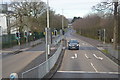
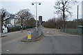
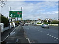
6
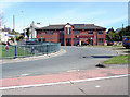
Junction of Morshead Road and Tavistock Road (A386), Plymouth
View facing Morshead Road.
Image: © MrC
Taken: 17 Apr 2009
0.06 miles
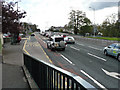
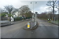
7
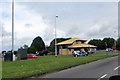
On the A386
This attractive building houses an optician's.
Image: © Robert Ashby
Taken: 3 Aug 2015
0.06 miles