IMAGES TAKEN NEAR TO
Plymouth Road, PLYMOUTH, PL3 6EF
Introduction
This page details the photographs taken nearby to Plymouth Road, PL3 6EF by members of the Geograph project.
The Geograph project started in 2005 with the aim of publishing, organising and preserving representative images for every square kilometre of Great Britain, Ireland and the Isle of Man.

There are currently over 7.5m images from over14,400 individuals and you can help contribute to the project by visiting https://www.geograph.org.uk
Image Map (Loading...)


Getting Data...Please wait
Leaflet Map data © OpenStreetMap
Images are licensed for reuse under creativecommons.org/licenses/by-sa/2.0
Notes
- Clicking on the map will re-center to the selected point.
- The higher the marker number, the further away the image location is from the centre of the postcode.
Image Listing (83 Images Found)
Images are licensed for reuse under creativecommons.org/licenses/by-sa/2.0
Image
Details
Distance
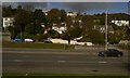
2
Plymouth Road
The A374 seen here heading in to Plymouth city centre.
Image: © jeff collins
Taken: 20 Aug 2014
0.05 miles

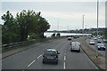

9
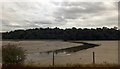
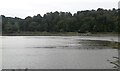
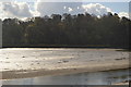
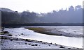
Plym at low tide
Across the river are the woods of the Saltram estate; on the left is the low dam of Blaxton Meadow Image
Image: © David Smith
Taken: 13 Aug 2013
0.10 miles