IMAGES TAKEN NEAR TO
Torr Lane, PLYMOUTH, PL3 5PB
Introduction
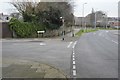
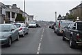
This page details the photographs taken nearby to Torr Lane, PL3 5PB by members of the Geograph project.
The Geograph project started in 2005 with the aim of publishing, organising and preserving representative images for every square kilometre of Great Britain, Ireland and the Isle of Man.

There are currently over 7.5m images from over14,400 individuals and you can help contribute to the project by visiting https://www.geograph.org.uk
Image Map
Images are licensed for reuse under creativecommons.org/licenses/by-sa/2.0
Notes
- Clicking on the map will re-center to the selected point.
- The higher the marker number, the further away the image location is from the centre of the postcode.
Image Listing (54 Images Found)
Images are licensed for reuse under creativecommons.org/licenses/by-sa/2.0
Image
Details
Distance
8
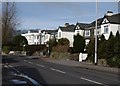
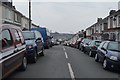
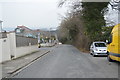
Torr Lane, Plymouth
Semi-detached houses along the east side of the road in Hartley, culminating in a fine white villa with attractive bays on the corner of Glentor Road.
Image: © Derek Harper
Taken: 27 Feb 2010
0.09 miles
9
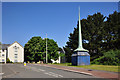
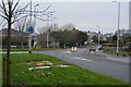
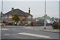
Frobisher Approach and turret - Manadon, Plymouth
Image: © Mick Lobb
Taken: 27 May 2010
0.10 miles