IMAGES TAKEN NEAR TO
Ruthys Lane, PADSTOW, PL28 8AZ

Introduction

This page details the photographs taken nearby to Ruthys Lane, PL28 8AZ by members of the Geograph project.

The Geograph project started in 2005 with the aim of publishing, organising and preserving representative images for every square kilometre of Great Britain, Ireland and the Isle of Man.

There are currently over 7.5m images from over14,400 individuals and you can help contribute to the project by visiting https://www.geograph.org.uk

Image Map


Images are licensed for reuse under creativecommons.org/licenses/by-sa/2.0
Notes
  • Clicking on the map will re-center to the selected point.
  • The higher the marker number, the further away the image location is from the centre of the postcode.

Image Listing (452 Images Found)

Images are licensed for reuse under creativecommons.org/licenses/by-sa/2.0
  • ...
Image
Details
Distance
1
Ruthy's Lane, Padstow
From its junction with Church Lane. See also Image] and Image
Image: © Derek Harper Taken: 11 Feb 2020
0.01 miles
2
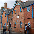
Victorian Almshouses. Padstow
See : Image
Image: © Chris J Dixon Taken: 23 Jun 2005
0.01 miles
3
Almshouses, Padstow (2)
These almshouses, built in 1875, are in Middle Street, Padstow. These are the gable ends of the two rows of dwellings which face a central courtyard. See also [http://www.geograph.org.uk/photo/1469765].
Image: © Andy F Taken: 23 Aug 2009
0.02 miles
4
Padstow sign
See : Image
Image: © Roy Parkhouse Taken: 23 Jul 2006
0.02 miles
5
Ruthy's Lane, Padstow
Linking Church Street, from which this was taken, to Church Lane.
Image: © Derek Harper Taken: 11 Feb 2020
0.02 miles
6
Ruthy's Lane, Padstow
A reverse view of Image], looking towards the junction with Church Street from about halfway along the lane.
Image: © Derek Harper Taken: 11 Feb 2020
0.02 miles
7
Padstow 'obby 'oss celebrations on May Day
A pagan Spring ritual held on 1st May every year when the red hobby horse ('obby 'oss) and the blue hobby horse parade around the town, each with its own band of supporters
Image: © Rod Allday Taken: 1 May 2006
0.02 miles
8
Almshouses, Padstow (1)
These almshouses, built in 1875, are in Middle Street, Padstow. There are two rows of dwellings facing a central courtyard, the gable ends facing the street (see also [http://www.geograph.org.uk/photo/1469767] ).
Image: © Andy F Taken: 23 Aug 2009
0.02 miles
9
Church Street, Padstow
Reflected sunlight from south-facing windows on the wall of the former school and school house at the corner of Ruthy's Lane. "... Elevation to Church Street has two 2-light casements in blocked door openings ..." https://historicengland.org.uk/listing/the-list/list-entry/1212265 . At the end of the street are sunlit buildings on Cross Street / Duke Street.
Image: © Derek Harper Taken: 11 Feb 2020
0.02 miles
10
Duke Street, Padstow
Looking towards market Strand.
Image: © Simon Huguet Taken: 7 Aug 2008
0.03 miles
  • ...