IMAGES TAKEN NEAR TO
St. Blazey Gate, PAR, PL24 2FR
Introduction
This page details the photographs taken nearby to PL24 2FR by members of the Geograph project.
The Geograph project started in 2005 with the aim of publishing, organising and preserving representative images for every square kilometre of Great Britain, Ireland and the Isle of Man.

There are currently over 7.5m images from over14,400 individuals and you can help contribute to the project by visiting https://www.geograph.org.uk
Image Map
Images are licensed for reuse under creativecommons.org/licenses/by-sa/2.0
Notes
- Clicking on the map will re-center to the selected point.
- The higher the marker number, the further away the image location is from the centre of the postcode.
Image Listing (11 Images Found)
Images are licensed for reuse under creativecommons.org/licenses/by-sa/2.0
Image
Details
Distance
2
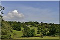
In fields near Lodge Hill
From fields near Lodge Hill, looking towards Carlyon Bay.
Image: © cynthia hudson
Taken: 22 Sep 2007
0.05 miles
3
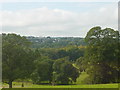
View to Biscovey church
View towards Church.
Image: © cynthia hudson
Taken: 22 Sep 2007
0.08 miles
5
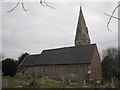
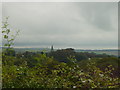
The church of St Mary the Virgin, Biscovey
Image: © Rod Allday
Taken: 19 Feb 2009
0.09 miles
6
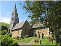
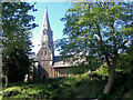
The Church of St Mary the Virgin at St Blazey Gate
Viewed from the south-east.
Image: © Peter Wood
Taken: 29 Apr 2017
0.10 miles
7
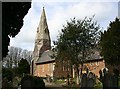
St Mary's Church, Biscovey
This church was completed in 1849 and was built mainly from the local reddish coloured Biscovey slates.
Image: © Tony Atkin
Taken: 28 Mar 2006
0.10 miles
8
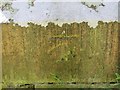
Ordnance Survey Cut Mark
This mark can be found on the wall of St Mary's Church at Blazey Gate. The benchmark height is recorded as being 58.848 metres above sea level.
For more detail see : http://www.bench-marks.org.uk/bm82383
Image: © Peter Wood
Taken: 29 Apr 2017
0.10 miles
9
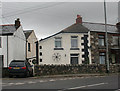
Tollhouse by the A390, St Austell Road, St Blazey Gate
Tollhouse by the A390, in the parish of St Blaise (Restormel District), St Blazey Toll House, St Austell Road, St Blazey Gate.
Cornwall & Scilly HER.
HER Number: 60035 https://www.heritagegateway.org.uk/Gateway/Results_Single.aspx?uid=MCO29702&resourceID=1020
Surveyed
Milestone Society National ID: CW.STA02
Image: © Alan Rosevear
Taken: 17 Nov 2008
0.20 miles
10
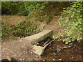
Stream crossing
This crossing is over a small stream in the woods near Tregrehan.
Image: © cynthia hudson
Taken: 22 Sep 2007
0.23 miles