IMAGES TAKEN NEAR TO
Stonehedge Close, IVYBRIDGE, PL21 0UF
Introduction
This page details the photographs taken nearby to Stonehedge Close, PL21 0UF by members of the Geograph project.
The Geograph project started in 2005 with the aim of publishing, organising and preserving representative images for every square kilometre of Great Britain, Ireland and the Isle of Man.

There are currently over 7.5m images from over14,400 individuals and you can help contribute to the project by visiting https://www.geograph.org.uk
Image Map (Loading...)


Getting Data...Please wait
Leaflet Map data © OpenStreetMap
Images are licensed for reuse under creativecommons.org/licenses/by-sa/2.0
Notes
- Clicking on the map will re-center to the selected point.
- The higher the marker number, the further away the image location is from the centre of the postcode.
Image Listing (72 Images Found)
Images are licensed for reuse under creativecommons.org/licenses/by-sa/2.0
Image
Details
Distance
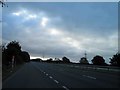
1
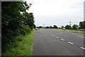
A38 Dual Carriageway
Looking East, just after Ivybridge.
Image: © jeff collins
Taken: 1 Aug 2009
0.09 miles
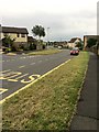
3
Ivybridge : Roundabout
A roundabout on the B3213 road.
Image: © Lewis Clarke
Taken: 19 Apr 2017
0.10 miles
5
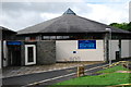
South Dartmoor Leisure Centre
Inside there are facilities for, Badminton, Basketball, Football, as well as a Gym. There are two Swimming Pools, one indoors and one outdoors. Situated by the river Erme.
Image: © jeff collins
Taken: 2 Aug 2008
0.11 miles
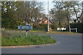
6
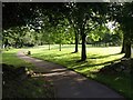
Park, Ivybridge
The path runs alongside the River Erme from the fire station to the leisure centre. This area of open space is between the river and housing on Paddock Way.
Image: © Derek Harper
Taken: 23 Jul 2009
0.13 miles
7
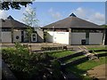
Ivybridge Leisure Centre
This also seems to be known as "South Dartmoor Leisure Centre", which might confuse, as South Dartmoor School is 20 kilometres away in Ashburton. Seen from a footbridge across the River Erme which connects it to the town centre.
Image: © Derek Harper
Taken: 23 Jul 2009
0.13 miles
8
Part of the Erme-Plym trail
The River Erme is just out of sight to the right. Taken from Marjorie Kelly Way.
Image: © jeff collins
Taken: 11 Apr 2020
0.14 miles
9
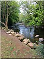
River Erme
Looking downstream . Close to the Erme-Plym Trail.
Image: © jeff collins
Taken: 18 Apr 2020
0.14 miles
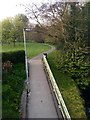
10
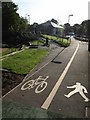
Dual use path, Ivybridge
Recent landscaping around Ivybridge Leisure Centre. On the left is Image In the background is a youth club.
Image: © Derek Harper
Taken: 23 Jul 2009
0.14 miles