IMAGES TAKEN NEAR TO
Langsford Road, TAVISTOCK, PL19 9LX
Introduction
This page details the photographs taken nearby to Langsford Road, PL19 9LX by members of the Geograph project.
The Geograph project started in 2005 with the aim of publishing, organising and preserving representative images for every square kilometre of Great Britain, Ireland and the Isle of Man.

There are currently over 7.5m images from over14,400 individuals and you can help contribute to the project by visiting https://www.geograph.org.uk
Image Map (Loading...)


Getting Data...Please wait
Leaflet Map data © OpenStreetMap
Images are licensed for reuse under creativecommons.org/licenses/by-sa/2.0
Notes
- Clicking on the map will re-center to the selected point.
- The higher the marker number, the further away the image location is from the centre of the postcode.
Image Listing (45 Images Found)
Images are licensed for reuse under creativecommons.org/licenses/by-sa/2.0
Image
Details
Distance
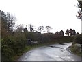
1

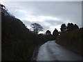
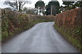
Road junction, Langsford
This is where National Cycle Routes 27 and 274 meet. The 274 ends at this point.
Image: © N Chadwick
Taken: 2 Dec 2017
0.07 miles
3
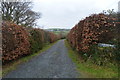
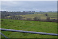
Trees against the sky at Langsford
The road from Peter Tavy to Langsford passes through a corner of this grid square. These trees surround the farm at Langsford.
Image: © David Smith
Taken: 2 Nov 2012
0.09 miles
10
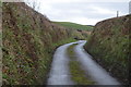
Bridge over stream south of Peter Tavy
This stream is a tributary of the River Tavy
Image: © David Smith
Taken: 2 Nov 2012
0.14 miles