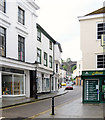
IMAGES TAKEN NEAR TO
King Street, TAVISTOCK, PL19 0DS

Introduction

This page details the photographs taken nearby to King Street, PL19 0DS by members of the Geograph project.

The Geograph project started in 2005 with the aim of publishing, organising and preserving representative images for every square kilometre of Great Britain, Ireland and the Isle of Man.

There are currently over 7.5m images from over14,400 individuals and you can help contribute to the project by visiting https://www.geograph.org.uk

Image Map


Images are licensed for reuse under creativecommons.org/licenses/by-sa/2.0
Notes
  • Clicking on the map will re-center to the selected point.
  • The higher the marker number, the further away the image location is from the centre of the postcode.

Image Listing (242 Images Found)

Images are licensed for reuse under creativecommons.org/licenses/by-sa/2.0
  • ...
Image
Details
Distance
1
Tavistock roofscape (2)
Viewed from Tavistock Viaduct, King Street in the foreground leads down to Market Street which then winds down to the church of St Eustachious in Image In the distance, over the wooded valley of the River Tavy, can be seen the residential areas in the east of the town.
Image: © Nigel Cox Taken: 6 Oct 2008
0.01 miles
2
Tavistock Corn Exchange
This was built at the time much of Tavistock was rebuilt by the Duke of Bedford in the middle of the 19th century. It is now a retail outlet.
Image: © Ian James Cox Taken: 30 Sep 2009
0.02 miles
3
Buildings on the corner
Of Market Street and Pym Street, Tavistock. Note the pigeons on the ledge of the right hand building.
Image: © Jonathan Billinger Taken: 9 Dec 2008
0.02 miles
4
Former Cornmarket
Grade II listed former Cornmarket for the Duke of Bedford 1835 on the site of the Green Dragon Inn. It was the town's first cinema 1913-1957, listed as Cook's Hardware Stores, now Fat Face clothing shop.
Image: © Richard Croft Taken: 8 Sep 2022
0.04 miles
5
The Union Inn
Cycle friendly hostelry on King Street
Image: © Richard Croft Taken: 8 Sep 2022
0.04 miles
6
King Street, Tavistock
Image: © MrC Taken: 1 May 2011
0.04 miles
7
Pym Street, Tavistock
Looking east from the Market Square on a showery December afternoon.
Image: © Jonathan Billinger Taken: 9 Dec 2008
0.04 miles
8
The Union Inn
In the background, crossing over Bannawell Street, is Image
Image: © Rod Allday Taken: 17 Nov 2010
0.05 miles
9
Ordnance Survey Cut Mark
This OS cut mark can be found on The Union Hotel, King Street. It marks a point 89.538m above mean sea level.
Image: © Adrian Dust Taken: 8 Apr 2014
0.05 miles
10
1 & 2 Taylor Square
Grade II listed early 19th century houses in Taylor Square. Named in recognition of John Taylor (1779-1863), mining entrepreneur and engineer responsible for the construction of the Tavistock Canal.
Image: © Richard Croft Taken: 8 Sep 2022
0.05 miles
  • ...