IMAGES TAKEN NEAR TO
Bakers Lane, GUNNISLAKE, PL18 9GJ
Introduction
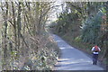
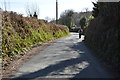
This page details the photographs taken nearby to Bakers Lane, PL18 9GJ by members of the Geograph project.
The Geograph project started in 2005 with the aim of publishing, organising and preserving representative images for every square kilometre of Great Britain, Ireland and the Isle of Man.

There are currently over 7.5m images from over14,400 individuals and you can help contribute to the project by visiting https://www.geograph.org.uk
Image Map (Loading...)


Getting Data...Please wait
Leaflet Map data © OpenStreetMap
Images are licensed for reuse under creativecommons.org/licenses/by-sa/2.0
Notes
- Clicking on the map will re-center to the selected point.
- The higher the marker number, the further away the image location is from the centre of the postcode.
Image Listing (23 Images Found)
Images are licensed for reuse under creativecommons.org/licenses/by-sa/2.0
Image
Details
Distance
1
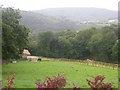
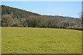
Arable and Woodland in the Tamar Valley
There seems to be more horses than cows grazing land in this square. This is possibly an indication of the changing economics of farming.
Image: © Tony Atkin
Taken: 31 Jul 2005
0.06 miles