IMAGES TAKEN NEAR TO
Liskeard Road, CALLINGTON, PL17 7HJ
Introduction
This page details the photographs taken nearby to Liskeard Road, PL17 7HJ by members of the Geograph project.
The Geograph project started in 2005 with the aim of publishing, organising and preserving representative images for every square kilometre of Great Britain, Ireland and the Isle of Man.

There are currently over 7.5m images from over14,400 individuals and you can help contribute to the project by visiting https://www.geograph.org.uk
Image Map (Loading...)


Getting Data...Please wait
Leaflet Map data © OpenStreetMap
Images are licensed for reuse under creativecommons.org/licenses/by-sa/2.0
Notes
- Clicking on the map will re-center to the selected point.
- The higher the marker number, the further away the image location is from the centre of the postcode.
Image Listing (4 Images Found)
Images are licensed for reuse under creativecommons.org/licenses/by-sa/2.0
Image
Details
Distance
1
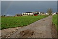
Rill Farm
There is just a hint of a rainbow in sky.
Image: © Tony Atkin
Taken: 9 Dec 2006
0.11 miles
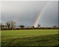
3
Field near Rill Farm
A young crop by Axford Hill.
Image: © Derek Harper
Taken: 4 Nov 2013
0.17 miles
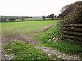
4
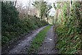
Track to Colquite
This farm track is also marked as a footpath on the map.
Image: © Tony Atkin
Taken: 9 Dec 2006
0.22 miles