IMAGES TAKEN NEAR TO
Hawks Tor Drive, LAUNCESTON, PL15 7QY

Introduction

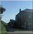
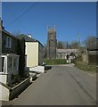
This page details the photographs taken nearby to Hawks Tor Drive, PL15 7QY by members of the Geograph project.

The Geograph project started in 2005 with the aim of publishing, organising and preserving representative images for every square kilometre of Great Britain, Ireland and the Isle of Man.

There are currently over 7.5m images from over14,400 individuals and you can help contribute to the project by visiting https://www.geograph.org.uk

Image Map


Images are licensed for reuse under creativecommons.org/licenses/by-sa/2.0
Notes
  • Clicking on the map will re-center to the selected point.
  • The higher the marker number, the further away the image location is from the centre of the postcode.

Image Listing (25 Images Found)

Images are licensed for reuse under creativecommons.org/licenses/by-sa/2.0
  • ...
Image
Details
Distance
1
The Archers Arms, Lewannick
The Archers Arms is in the centre of the village, 1 mile from the A30. They serve real ales, good choice of wines, an open fire and a friendly welcome.
Image: © Brian Green Taken: 27 Jul 2007
0.02 miles
2
Ebenezer
Image: © Paul Barnett Taken: Unknown
0.11 miles
3
Beacon View, Lewannick
Image: © Alex McGregor Taken: 9 Apr 2013
0.12 miles
4
The village of Lewannick
Looking towards Image
Image: © Rod Allday Taken: 30 Oct 2016
0.12 miles
5
Lewannick
The village street approaching the Church of St Martin http://www.historicengland.org.uk/listing/the-list/list-entry/1277508 , and taken a little further back than Image
Image: © Derek Harper Taken: 14 Apr 2015
0.13 miles
6
Lych gate and lane, Lewannick
The lych gate is opposite the junction seen in Image and appears in that image. The lane forms the eastern side of an oval-shaped enclosure around the churchyard. On the right is Bovetown Farm.
Image: © Derek Harper Taken: 14 Apr 2015
0.14 miles
7
Lewannick Village Hall
This shows three important aspects of village life: the village hall, the war memorial and the church. Just behind the photographer is the fourth: the village pub.. The Archer Arms.
Image: © Brian Green Taken: 27 Jul 2007
0.14 miles
8
Village lane, Lewannick
Leading west from the lych gate Image], with the churchyard on the right, and the old police house on the left.
Image: © Derek Harper Taken: 14 Apr 2015
0.15 miles
9
Old Direction Sign - Signpost by Tinney Hall junction, Lewannick
Pyramid finial - Stirch repair; by the UC road, in parish of Lewannick (North Cornwall District), Tinney Hall turn, on wide grass verge. Surveyed Milestone Society National ID: CW_SX2780
Image: © Milestone Society Taken: Unknown
0.15 miles
10
St Martin's church, Lewannick
Image: © Dave Kelly Taken: 14 Mar 2008
0.15 miles
  • ...