IMAGES TAKEN NEAR TO
Callington Road, SALTASH, PL12 6EA
Introduction
This page details the photographs taken nearby to Callington Road, PL12 6EA by members of the Geograph project.
The Geograph project started in 2005 with the aim of publishing, organising and preserving representative images for every square kilometre of Great Britain, Ireland and the Isle of Man.

There are currently over 7.5m images from over14,400 individuals and you can help contribute to the project by visiting https://www.geograph.org.uk
Image Map
Images are licensed for reuse under creativecommons.org/licenses/by-sa/2.0
Notes
- Clicking on the map will re-center to the selected point.
- The higher the marker number, the further away the image location is from the centre of the postcode.
Image Listing (72 Images Found)
Images are licensed for reuse under creativecommons.org/licenses/by-sa/2.0
Image
Details
Distance
1
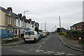
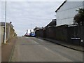
Longview Road, Saltash
The terrace at the eastern end of Longview Road, Saltash. The remainder of the road is made up of a mix of detached/semi-detached houses opposite the terrace, and bungalows along both sides for the rest of its length.
Image: © Kevin Hale
Taken: 25 Dec 2008
0.04 miles
4
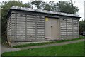
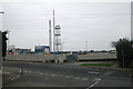
Electricity sub station, Alamein Road, Saltash
Pre-cast concrete electricity sub station, Alamein Road, Saltash.
Image: © Kevin Hale
Taken: 17 Oct 2005
0.04 miles

6
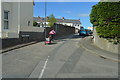
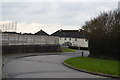
Lollabury Road, Saltash
Old maps show there was a quarry near the top of the slope called Lollabury Quarry - an unusual name
Image: © David Smith
Taken: 25 Feb 2016
0.05 miles
9
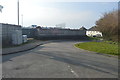
Kimberley Stadium, Saltash
The entrance to Kimberley Stadium, Callington Road, Saltash, home to Saltash United Football Club. Sainsbury's recently (2008) wanted to build a supermarket on the site and a small part of the Warfelton playing fields at the rear of the stadium, and in return build a brand new stadium on the edge of the town. Due to vocal local opposition, they appear to have shelved their current plans.
Image: © Kevin Hale
Taken: 25 Dec 2008
0.06 miles
10
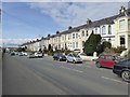
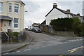
Terraced house in Callington Road, Saltash
This is first marked on the 1905 OS map as Kimberley Terrace, reflecting the place name from the Boer War
Image: © David Smith
Taken: 25 Feb 2016
0.07 miles