IMAGES TAKEN NEAR TO
Polbathic, TORPOINT, PL11 3HG

Introduction

This page details the photographs taken nearby to PL11 3HG by members of the Geograph project.

The Geograph project started in 2005 with the aim of publishing, organising and preserving representative images for every square kilometre of Great Britain, Ireland and the Isle of Man.

There are currently over 7.5m images from over14,400 individuals and you can help contribute to the project by visiting https://www.geograph.org.uk

Image Map


Images are licensed for reuse under creativecommons.org/licenses/by-sa/2.0
Notes
  • Clicking on the map will re-center to the selected point.
  • The higher the marker number, the further away the image location is from the centre of the postcode.

Image Listing (25 Images Found)

Images are licensed for reuse under creativecommons.org/licenses/by-sa/2.0
  • ...
Image
Details
Distance
1
Halfway House Pub on A374
The pub on the map in real life stands proud at the head of an estuary inlet. The pub is a good waypoint as roads go off in all directions from it. I wish I could hear some of the conversations that went on in there in olden days. Oh yes.
Image: © BB Taken: 19 Feb 2007
0.02 miles
2
A374 through Polbathic
Heading east.
Image: © JThomas Taken: 7 Nov 2014
0.02 miles
3
Old Milepost by the A374, Polbathic
Cast iron post by the A374, in parish of ST GERMANS (CARADON District), Polbathic, just West of crossroads, against low wall, almost buried, on North side of road. Torpoint iron spear, erected by the Liskeard turnpike trust in the 19th century. Inscription reads:- : TORPOINT / 8 : : LISKEARD / 8½ : Grade II Listed. List Entry Number:1140513 https://historicengland.org.uk/listing/the-list/list-entry/1140513 Milestone Society National ID: CW_TPLK08.
Image: © Ian Thompson Taken: 1 Apr 2003
0.02 miles
4
Old Milepost by the A374, Polbathic
Cast iron post by the A374, in parish of ST GERMANS (CARADON District), Polbathic, just West of crossroads, against low wall, almost buried, on North side of road. Torpoint iron spear, erected by the Liskeard turnpike trust in the 19th century. Inscription reads:- : TORPOINT / 8 : : LISKEARD / 8½ : Grade II listed. List Entry Number: 1140513 https://historicengland.org.uk/listing/the-list/list-entry/1140513 Milestone Society National ID: CW_TPLK08.
Image: © Rosy Hanns Taken: 14 Apr 2019
0.03 miles
5
Car park, Polbathic
Image: © N Chadwick Taken: 22 Apr 2017
0.03 miles
6
Junction, Polbathic
The junction of the A374 with the B3249 to St Germans. This is a reverse view of Image, taken over 53 years earlier.
Image: © Derek Harper Taken: 30 Nov 2013
0.03 miles
7
The Halfway House, Polbathic
On the A374. See http://www.geograph.org.uk/photo/3769467 and http://www.geograph.org.uk/photo/342931 for other views.
Image: © JThomas Taken: 7 Nov 2014
0.03 miles
8
B3249
Image: © N Chadwick Taken: 22 Apr 2017
0.04 miles
9
Junction, Polbathic
The B3249 to St Germans leaves the A374 in the village. See Image], which looks at the junction from the left.
Image: © Derek Harper Taken: 30 Nov 2013
0.04 miles
10
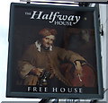
Sign for the Halfway House, Polbathic
Image: © JThomas Taken: 7 Nov 2014
0.04 miles
  • ...