IMAGES TAKEN NEAR TO
Trevol Business Park, TORPOINT, PL11 2TB
Introduction
This page details the photographs taken nearby to Trevol Business Park, PL11 2TB by members of the Geograph project.
The Geograph project started in 2005 with the aim of publishing, organising and preserving representative images for every square kilometre of Great Britain, Ireland and the Isle of Man.

There are currently over 7.5m images from over14,400 individuals and you can help contribute to the project by visiting https://www.geograph.org.uk
Image Map
Images are licensed for reuse under creativecommons.org/licenses/by-sa/2.0
Notes
- Clicking on the map will re-center to the selected point.
- The higher the marker number, the further away the image location is from the centre of the postcode.
Image Listing (14 Images Found)
Images are licensed for reuse under creativecommons.org/licenses/by-sa/2.0
Image
Details
Distance
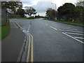
1
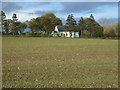
By Penntorr Health
Penntorr Health is housed in the building on the left. Beyond the security fence and the footpath is a building on the Spickerhnell depot at HMS Raleigh. The car park belongs to the Kingdom Hall and the distant houses are on Frobisher Way.
Image: © Derek Harper
Taken: 19 May 2018
0.08 miles
2

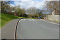
Business units, Trevol Business Park
There are four units in this building seen from Trevol Road.
Image: © Derek Harper
Taken: 19 May 2018
0.13 miles
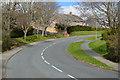
3
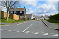
Entering Torpoint
Heading east on Trevol Road.
Image: © JThomas
Taken: 7 Nov 2014
0.16 miles
4
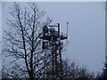
Radio Mast behind Lamorna Park, Torpoint
This is similar Radio Mast to the one at Thanckes Fuel Depot in Image http://www.geograph.org.uk/photo/2336013. They don't 'point' at each other. They don't even point in the same direction. This one appears to point toward the Plympton Transmitter while the one at Thanckes appears to point at the Crownhill Transmitter. This is based on the direction that the two dish antennae point. I don't know the purpose of these masts but would like to know more if anyone has any information.
Image: © Adrian Eades
Taken: 30 Mar 2011
0.16 miles
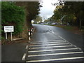
7
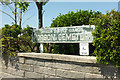
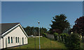
Horson Cemetery
The sign at the entrance to Image
Image: © Derek Harper
Taken: 19 May 2018
0.18 miles