IMAGES TAKEN NEAR TO
Butterstone, DUNKELD, PH8 0EU

Introduction

This page details the photographs taken nearby to PH8 0EU by members of the Geograph project.

The Geograph project started in 2005 with the aim of publishing, organising and preserving representative images for every square kilometre of Great Britain, Ireland and the Isle of Man.

There are currently over 7.5m images from over14,400 individuals and you can help contribute to the project by visiting https://www.geograph.org.uk

Image Map


Images are licensed for reuse under creativecommons.org/licenses/by-sa/2.0
Notes
  • Clicking on the map will re-center to the selected point.
  • The higher the marker number, the further away the image location is from the centre of the postcode.

Image Listing (14 Images Found)

Images are licensed for reuse under creativecommons.org/licenses/by-sa/2.0
Image
Details
Distance
1
Craiglush Cottage
On the A923 as it skirts round the northern end of the Loch of Craiglush.
Image: © M J Richardson Taken: 14 Aug 2017
0.01 miles
2
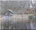
No fishing
With boathouse surrounded by reeds and ice covering the Loch of Craiglush certainly no fishing today.
Image: © Russel Wills Taken: 1 Jan 2009
0.07 miles
3
Craiglush Cottage
The A923 from Dunkeld to Blairgowrie can be quite busy at times; these were the last two motorcyclists of a dozen or so to pass us at this spot.
Image: © Lis Burke Taken: 6 Oct 2007
0.07 miles
4
Loch of Craiglush in winter
Looking south over the frozen loch. A thaw has begun so there is water on top of the ice.
Image: © Lis Burke Taken: 7 Jan 2006
0.11 miles
5
Oak wood, Cardney
Sessile oak woods without the dreaded rhododendron.
Image: © Richard Webb Taken: 6 Sep 2013
0.19 miles
6
Old Milestone by the A923, Loch of Lowes
Stone post by the A923, in parish of Dunkeld and Dowally (Perth and Kinross District), North of Loch of Lowes, on verge by stone wall. Inscription reads:- : DUNKELD / 3 : : BLAIR / GOWRIE / 9 : Surveyed Milestone Society National ID: PK_BGDK09
Image: © Milestone Society Taken: Unknown
0.20 miles
7
Milestone near Butterstone
The milestone stands beside the A923 indicating that it is three miles to Dunkeld and nine miles to Blairgowrie. Milestones did not come into general use until the Turnpike Act of 1766 made them compulsory on turnpike roads, these roads were built by private enterprise under licence from the Government and maintained by tolls on those who used them. Before this Act milestones were put up occasionally, often as charitable acts and commemorations. Many Turnpike Act stones still exist. They are usually 2-3 ft high, with the initial letter or abbreviation of the nearest market town show on two faces, and the distance from it. For a wider view of the stone Image
Image: © Maigheach-gheal Taken: 14 Oct 2010
0.21 miles
8
Douglas firs, Cardney
Some very big trees.
Image: © Richard Webb Taken: 6 Sep 2013
0.22 miles
9
Woodland track, Cardney
The track runs up to the Cardney Loch through mostly oak woods with some specimen conifers.
Image: © Richard Webb Taken: 6 Sep 2013
0.22 miles
10
Contradiction
A welcome sign in Perthshire which at least implies that the owners/managers are tolerant of visitors. The top bit says you must not tie up your dogs, while the words say dogs on leads. The meaning is pretty clear though.
Image: © Richard Webb Taken: 6 Sep 2013
0.22 miles