IMAGES TAKEN NEAR TO
Dallerie, CRIEFF, PH7 4JH
Introduction
This page details the photographs taken nearby to Dallerie, PH7 4JH by members of the Geograph project.
The Geograph project started in 2005 with the aim of publishing, organising and preserving representative images for every square kilometre of Great Britain, Ireland and the Isle of Man.

There are currently over 7.5m images from over14,400 individuals and you can help contribute to the project by visiting https://www.geograph.org.uk
Image Map (88 Images)
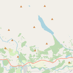
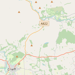
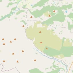
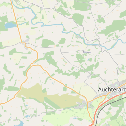
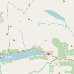


Leaflet Map data © OpenStreetMap
Images are licensed for reuse under creativecommons.org/licenses/by-sa/2.0
Notes
- Clicking on the map will re-center to the selected point.
- The higher the marker number, the further away the image location is from the centre of the postcode.
Image Listing (88 Images Found)
Images are licensed for reuse under creativecommons.org/licenses/by-sa/2.0
Image
Details
Distance
2
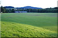
Morrison's Academy playing fields
School sports facilities next to the River Earn. The river is beyond the trees.
Image: © Bill Boaden
Taken: 26 Jul 2013
0.05 miles
3
Northern section of Lady Mary's walk
Taken on the road back into Crieff, heading towards Oakbank pub
Image: © Eva Forbes
Taken: 10 Jul 2003
0.06 miles
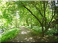
5
Path from Sauchie Place to a recreation ground
Image: © Basher Eyre
Taken: 13 Aug 2014
0.10 miles
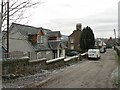
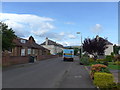
6
Approaching the junction of Sauchie Place and Dallerie Road
Image: © Basher Eyre
Taken: 13 Aug 2014
0.11 miles
7
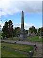
A midday visit to Gallowhill Cemetery, Crieff (viii)
Image: © Basher Eyre
Taken: 13 Aug 2014
0.11 miles
8
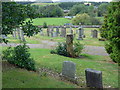
A midday visit to Gallowhill Cemetery, Crieff (ix)
Image: © Basher Eyre
Taken: 13 Aug 2014
0.11 miles
10
Lady Mary's Walk
Lady Mary's Walk by the River Earn
Image: © James Hearton
Taken: 28 May 2006
0.11 miles