IMAGES TAKEN NEAR TO
CRIEFF, PH7 4HE

Introduction

This page details the photographs taken nearby to PH7 4HE by members of the Geograph project.

The Geograph project started in 2005 with the aim of publishing, organising and preserving representative images for every square kilometre of Great Britain, Ireland and the Isle of Man.

There are currently over 7.5m images from over14,400 individuals and you can help contribute to the project by visiting https://www.geograph.org.uk

Image Map


Images are licensed for reuse under creativecommons.org/licenses/by-sa/2.0
Notes
  • Clicking on the map will re-center to the selected point.
  • The higher the marker number, the further away the image location is from the centre of the postcode.

Image Listing (11 Images Found)

Images are licensed for reuse under creativecommons.org/licenses/by-sa/2.0
Image
Details
Distance
1
Monzie Bridge
The packhorse bridge over Shaggie Burn dates from the early 19th century.
Image: © Maigheach-gheal Taken: 16 Apr 2011
0.02 miles
2
Postbox, Monzie
A Victorian reign postbox set into a high wall opposite the church.
Image: © Maigheach-gheal Taken: 16 Apr 2011
0.04 miles
3
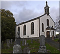
Monzie Kirk
Monzie is a small settlement close to the Shaggie Burn and north of Crieff; this is its church.
Image: © Trevor Littlewood Taken: 30 Oct 2010
0.04 miles
4
Monzie Parish Church, near Crieff, Perthshire
Built 1830/31
Image: © Brian D Osborne Taken: 5 Sep 2005
0.05 miles
5
Monzie Kirk
The kirk was designed by William Stirling and built in 1930-31.
Image: © Maigheach-gheal Taken: 16 Apr 2011
0.05 miles
6
Monzie Village Hall
Situated near the church is this corrugated iron building which looks like it is used as a village hall.
Image: © Maigheach-gheal Taken: 16 Apr 2011
0.06 miles
7
Flush Bracket G1135, Monzie Kirk
Ordnance Survey flush bracket G1135 is to be found on south face of the building. For a wider view of the building Image and for further information on the bracket and others in the area http://www.bench-marks.org.uk/bm20028
Image: © Maigheach-gheal Taken: 16 Apr 2011
0.06 miles
8
Monzie Kirk
The no longer in use Monzie Kirk, viewed from the roadside entrance.
Image: © Scott Cormie Taken: 26 Aug 2024
0.06 miles
9
Kirkyard, Monzie
The kirkyard contains burials from many generations, showing the Church's concern for its parishioners in this life and beyond the grave. The stones tell the history of the Parish and reflect changing attitudes and fashions.
Image: © Maigheach-gheal Taken: 16 Apr 2011
0.06 miles
10
Ivy on the walls, Monzie
The walls of the derelict building are covered in ivy. Ivy is an excellent winter food source for birds. The ivy blooms near the end of the year, usually around November. Although its flowers are small and inconspicuous, they attract many late-flying insects. These provide tasty nibbles for birds such as the wren, dunnock, robin and blue-tit. Later on, when the ivy berries turn black, they will be gobbled up by the blackbirds and wood-pigeons. Winter visitors such as redwings and fieldfares will also benefit from this late feast, especially if it has been a hard winter. Common Ivy was used by mediaeval herbalists to treat the bloody flux. Today, its modern use is not recommended internally as it can cause the destruction of red blood cells. The leaves however, are used by master herbalists as poultices for boils and abscesses.
Image: © Maigheach-gheal Taken: 16 Apr 2011
0.07 miles