IMAGES TAKEN NEAR TO
Reid Place, CRIEFF, PH7 3NT
Introduction
This page details the photographs taken nearby to Reid Place, PH7 3NT by members of the Geograph project.
The Geograph project started in 2005 with the aim of publishing, organising and preserving representative images for every square kilometre of Great Britain, Ireland and the Isle of Man.

There are currently over 7.5m images from over14,400 individuals and you can help contribute to the project by visiting https://www.geograph.org.uk
Image Map
Images are licensed for reuse under creativecommons.org/licenses/by-sa/2.0
Notes
- Clicking on the map will re-center to the selected point.
- The higher the marker number, the further away the image location is from the centre of the postcode.
Image Listing (107 Images Found)
Images are licensed for reuse under creativecommons.org/licenses/by-sa/2.0
Image
Details
Distance
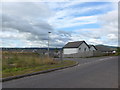
2
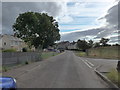
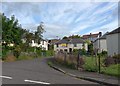
Craig Rossie View
Part of a new housing development on the edge of Crieff.
Image: © Rob Burke
Taken: 14 Jun 2011
0.02 miles
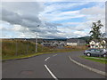
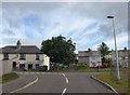
4
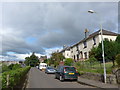
Approaching the junction of Maxton Road and Reid Place
Image: © Basher Eyre
Taken: 13 Aug 2014
0.02 miles
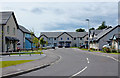
5
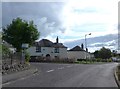
Looking from Reid Place into Maxton Road
Image: © Basher Eyre
Taken: 13 Aug 2014
0.03 miles