IMAGES TAKEN NEAR TO
CRIEFF, PH7 3NQ
Introduction
This page details the photographs taken nearby to PH7 3NQ by members of the Geograph project.
The Geograph project started in 2005 with the aim of publishing, organising and preserving representative images for every square kilometre of Great Britain, Ireland and the Isle of Man.

There are currently over 7.5m images from over14,400 individuals and you can help contribute to the project by visiting https://www.geograph.org.uk
Image Map
Images are licensed for reuse under creativecommons.org/licenses/by-sa/2.0
Notes
- Clicking on the map will re-center to the selected point.
- The higher the marker number, the further away the image location is from the centre of the postcode.
Image Listing (4 Images Found)
Images are licensed for reuse under creativecommons.org/licenses/by-sa/2.0
Image
Details
Distance
3
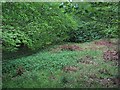
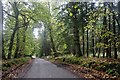
Woods, Abercariny
Clearing in the dense woodland surrounding Abercairney. Light was an issue here, very dark with heavy rain bearing clouds in the west.
Image: © Richard Webb
Taken: 13 May 2007
0.10 miles
4
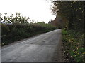
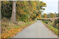
Minor road near Abercairny
This road reaches Kinkell Bridge in about 6km, and Auchterarder after a further 5km.
Image: © David Purchase
Taken: 2 Nov 2011
0.15 miles