
IMAGES TAKEN NEAR TO
Comrie, CRIEFF, PH6 2JJ
Introduction
This page details the photographs taken nearby to PH6 2JJ by members of the Geograph project.
The Geograph project started in 2005 with the aim of publishing, organising and preserving representative images for every square kilometre of Great Britain, Ireland and the Isle of Man.

There are currently over 7.5m images from over14,400 individuals and you can help contribute to the project by visiting https://www.geograph.org.uk
Image Map
Images are licensed for reuse under creativecommons.org/licenses/by-sa/2.0
Notes
- Clicking on the map will re-center to the selected point.
- The higher the marker number, the further away the image location is from the centre of the postcode.
Image Listing (4 Images Found)
Images are licensed for reuse under creativecommons.org/licenses/by-sa/2.0
Image
Details
Distance
1
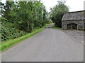
Glen Artney - Minor road at Mailerbeg
Looking south-westward.
Image: © Peter Wood
Taken: 6 Sep 2022
0.03 miles
2

Ordnance Survey Cut Mark
This mark can be found on the wall of a barn at Mailerbeg.
The recorded details give a height of 202.4665 metres above sea level.
For more detail see : https://www.bench-marks.org.uk/bm179767
Image: © Peter Wood
Taken: 6 Sep 2022
0.04 miles
3
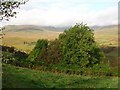
Glen Artney
A field just clear of the bracken which plagues much of the southern side of the glen. Beyond, in the cloud, Beinn Dearg.
Image: © Richard Webb
Taken: 8 Oct 2006
0.10 miles
4
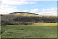
Glen Artney and Ben Halton
Fields beside the Water of Ruchil in Glen Artney.
Image: © Richard Webb
Taken: 9 May 2015
0.22 miles