
IMAGES TAKEN NEAR TO
Comrie, CRIEFF, PH6 2JE
Introduction
This page details the photographs taken nearby to PH6 2JE by members of the Geograph project.
The Geograph project started in 2005 with the aim of publishing, organising and preserving representative images for every square kilometre of Great Britain, Ireland and the Isle of Man.

There are currently over 7.5m images from over14,400 individuals and you can help contribute to the project by visiting https://www.geograph.org.uk
Image Map
Images are licensed for reuse under creativecommons.org/licenses/by-sa/2.0
Notes
- Clicking on the map will re-center to the selected point.
- The higher the marker number, the further away the image location is from the centre of the postcode.
Image Listing (29 Images Found)
Images are licensed for reuse under creativecommons.org/licenses/by-sa/2.0
Image
Details
Distance
1
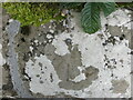
Ordnance Survey Cut Mark with Rivet
This mark and rivet can be found on the top of the parapet wall of a bridge spanning Auchingarrich Burn,
The recorded details give a height of 112.2548 metres above sea level.
For more detail see : https://www.bench-marks.org.uk/bm179765
Image: © Peter Wood
Taken: 6 Sep 2022
0.02 miles
2
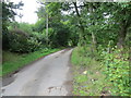
Minor road at Auchingarrich
Looking north-westward.
Image: © Peter Wood
Taken: 6 Sep 2022
0.02 miles
3

Mallards (Anas platyrhynchos), Auchingarrich
Foraging in the pig pen.
Image: © Mike Pennington
Taken: 10 Apr 2012
0.09 miles
4
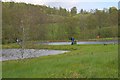
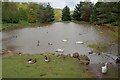
Fishing Ponds, Auchingarrich Estate
Part of the Wildlife Centre.
Image: © Mick Garratt
Taken: 28 May 2011
0.10 miles
5
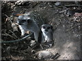
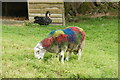
Don't look at me for cheap car insurance!
Simples...
Image: © Alasdair MacNeill
Taken: 3 Jul 2010
0.11 miles
7
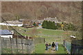
Auchingarrich Wildlife Centre
Looking across the valley to the birchwoods of Mill of Fortune Copse.
Image: © Mike Pennington
Taken: 5 Apr 2009
0.13 miles
8
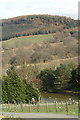
View east from Auchingarrich
Looking over one of the ponds for ornamental wildfowl in the Wildlife Centre, towards the wooded hill of Barr Dubh.
Image: © Mike Pennington
Taken: 5 Apr 2009
0.13 miles
10
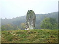
Auchingarrich Standing Stone
Known locally as the Roman Stone, and formerly "supposed to mark the grave of one of the heroes who fell at the battle of [Mons Graupius]", this stone is over 8 feet tall, and bears some cup markings on its surface; see: https://canmore.org.uk/site/24795/auchingarrich-farm (at Canmore) for further information.
See Image for another view of the stone, which stands close to Auchingarrich Wildlife Centre.
There are many cairns and standing stones here in the valley of the River Earn, and, in its role as a monument, the stone is probably about 4000 years old, or about twice as old as folklore (see first paragraph) would have it.
A plaque near the stone provides more information about the site: Image
Image: © Lairich Rig
Taken: 15 Oct 2007
0.15 miles