IMAGES TAKEN NEAR TO
Muthill, CRIEFF, PH5 2DF
Introduction
This page details the photographs taken nearby to PH5 2DF by members of the Geograph project.
The Geograph project started in 2005 with the aim of publishing, organising and preserving representative images for every square kilometre of Great Britain, Ireland and the Isle of Man.

There are currently over 7.5m images from over14,400 individuals and you can help contribute to the project by visiting https://www.geograph.org.uk
Image Map
Images are licensed for reuse under creativecommons.org/licenses/by-sa/2.0
Notes
- Clicking on the map will re-center to the selected point.
- The higher the marker number, the further away the image location is from the centre of the postcode.
Image Listing (9 Images Found)
Images are licensed for reuse under creativecommons.org/licenses/by-sa/2.0
Image
Details
Distance
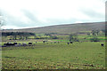
3
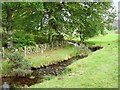
Lurgan Burn
Burn now entering farmland after flowing through the forest on Lurgan Hill.
Image: © Richard Webb
Taken: 8 Oct 2006
0.18 miles
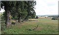
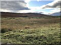
5
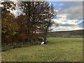
Near Craggan
Beeches still putting up a display.
Image: © Richard Webb
Taken: 7 Nov 2023
0.21 miles
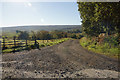
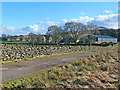
8
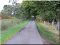
Road from Craggan Camp to Craggan
Looking south-eastward.
Image: © Peter Wood
Taken: 3 Oct 2017
0.25 miles