
IMAGES TAKEN NEAR TO
Lundavra Crescent, FORT WILLIAM, PH33 6JL
Introduction
This page details the photographs taken nearby to Lundavra Crescent, PH33 6JL by members of the Geograph project.
The Geograph project started in 2005 with the aim of publishing, organising and preserving representative images for every square kilometre of Great Britain, Ireland and the Isle of Man.

There are currently over 7.5m images from over14,400 individuals and you can help contribute to the project by visiting https://www.geograph.org.uk
Image Map
Images are licensed for reuse under creativecommons.org/licenses/by-sa/2.0
Notes
- Clicking on the map will re-center to the selected point.
- The higher the marker number, the further away the image location is from the centre of the postcode.
Image Listing (34 Images Found)
Images are licensed for reuse under creativecommons.org/licenses/by-sa/2.0
Image
Details
Distance
1
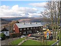
Achadh an Todhair - Auchintore
Playground and Scandinavian style wooden housing in Fort William. Druim Fhada in the background.
Image: © Richard Webb
Taken: 16 Mar 2008
0.10 miles
2
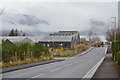
Lundavra Primary School, Fort William
The school on Lundavra Road on the hill above the town. It also houses a nursery and community facilities.
Image: © Jim Barton
Taken: 16 Nov 2019
0.11 miles
3
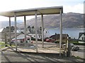
Bus shelter, Achadh an Todhair - Auchintore
No glass remains, probably due to the traditional reason.
Image: © Richard Webb
Taken: 16 Mar 2008
0.12 miles
4
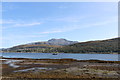
Fort William and the 'Grey Elephant'
Ben Nevis towers over Fort William. The Ben is sometimes known amongst older generations of hillwalkers and climbers as the 'Grey Elephant' but you have to view it from the right angle (south west) and it can take a little stretching of the imagination to see the figure of a recumbent elephant - the hindquarters are on the left, the lump in the middle is the head and the outstretched trunk is towards the right. This is better seen when Ben Nevis is wearing its winter coat https://www.eclectech.co.uk/b3ta/benneviselephant.jpg.html
Image: © Bill Kasman
Taken: 20 Sep 2020
0.12 miles
5
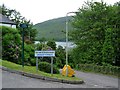
A residential area of south Fort William
A few streets climb steeply from the sea front
Image: © Alan Reid
Taken: 11 Jun 2012
0.13 miles
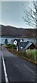
7
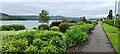
Gardens alongside Achintore Road, Fort William
Image: © Chris Morgan
Taken: 23 Jun 2021
0.14 miles
8
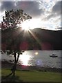
Setting sun over Meall an t-Slamain from Fort William
Image: © Gareth James
Taken: 26 Jul 2012
0.16 miles
10
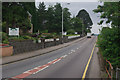
Achintore Road, Fort William
The A82 heading out of Fort William towards Ballachulish is lined on one side with small hotels and bed and breakfast accommodation.
Image: © Stephen McKay
Taken: 15 Jul 2011
0.16 miles