IMAGES TAKEN NEAR TO
Free Church Road, FORT AUGUSTUS, PH32 4DQ
Introduction
This page details the photographs taken nearby to Free Church Road, PH32 4DQ by members of the Geograph project.
The Geograph project started in 2005 with the aim of publishing, organising and preserving representative images for every square kilometre of Great Britain, Ireland and the Isle of Man.

There are currently over 7.5m images from over14,400 individuals and you can help contribute to the project by visiting https://www.geograph.org.uk
Image Map
Images are licensed for reuse under creativecommons.org/licenses/by-sa/2.0
Notes
- Clicking on the map will re-center to the selected point.
- The higher the marker number, the further away the image location is from the centre of the postcode.
Image Listing (144 Images Found)
Images are licensed for reuse under creativecommons.org/licenses/by-sa/2.0
Image
Details
Distance
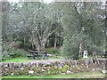
3
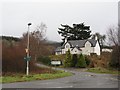
Blairconard
Northern edge of Fort Augustus. Signs include those for the Great Glen Way and various core paths.
Image: © Richard Webb
Taken: 1 Jan 2007
0.09 miles
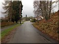
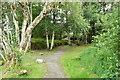
5
Fort Augustus
Looking towards the car park.
Image: © Danny P Robinson
Taken: 1 Jul 2006
0.12 miles
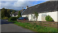
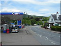
6
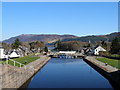
Looking down the locks at Fort Augustus
This is looking down toward Loch Ness. This village with the locks on the canal is a very pretty and popular place.
Image: © Dorcas Sinclair
Taken: Unknown
0.12 miles
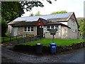
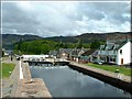
8
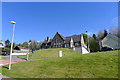
Former Bunoich School, Fort Augustus
Part of a LIFT shared-equity housing scheme
Image: © Tim Heaton
Taken: 6 May 2017
0.12 miles