IMAGES TAKEN NEAR TO
Fort William Road, FORT AUGUSTUS, PH32 4DP

Introduction

This page details the photographs taken nearby to Fort William Road, PH32 4DP by members of the Geograph project.

The Geograph project started in 2005 with the aim of publishing, organising and preserving representative images for every square kilometre of Great Britain, Ireland and the Isle of Man.

There are currently over 7.5m images from over14,400 individuals and you can help contribute to the project by visiting https://www.geograph.org.uk

Image Map


Images are licensed for reuse under creativecommons.org/licenses/by-sa/2.0
Notes
  • Clicking on the map will re-center to the selected point.
  • The higher the marker number, the further away the image location is from the centre of the postcode.

Image Listing (112 Images Found)

Images are licensed for reuse under creativecommons.org/licenses/by-sa/2.0
  • ...
Image
Details
Distance
1
Houses on the A82 at Fort Augustus
Image: © Ian S Taken: 31 May 2021
0.03 miles
2
White House by the A82, Fort Augustus
Image: © Peter Bond Taken: 9 Nov 2014
0.04 miles
3
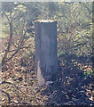
Triangulation pillar, Fort Augustus, Inverness-shire
This is one of the Great Glen Project pillars which were built in the 1970s as part of a geological study of crustal movement.
Image: © Claire Pegrum Taken: 18 Dec 2021
0.08 miles
4
Great Glen Project Station Q Trig Point - No Flush Bracket
The Great Glen Project was a geological study of the crustal movement across the Great Glen. Around 15 pillars, both Hotine and Vanessa, were constructed. Most of the pillars have flush brackets, but are not shown on OS maps.
Image: © thejackrustles Taken: 11 Mar 2015
0.08 miles
5
Rainbow over cottages
A heavy morning shower produced this spectacular double rainbow as seen from the Bank House.
Image: © Tiger Taken: 16 Oct 2007
0.13 miles
6
Caledonian Canal Fort Augustus Basin
The canal has been dewatered during upgrades and repair to the lock gates at Fort Augustus and Kyltra
Image: © valenta Taken: 15 Feb 2019
0.16 miles
7
Caledonian Canal
View looking east towards Loch Ness.
Image: © Dennis Turner Taken: 20 Jun 2005
0.16 miles
8
Above the locks at Fort Augustus
Yachts and cruisers moored on the Caledonian Canal in the evening, waiting for the first downward locking the following morning.
Image: © John Allan Taken: 1 Jul 2007
0.16 miles
9
Caledonian Canal
From the top lock towards Loch Ness
Image: © hayley green Taken: 28 Oct 2009
0.16 miles
10
Fort Augustus and the Caledonian Canal
An extensive view back to Fort Augustus and its surroundings from the high level Great Glen Way path. In the distance is Loch Oich, and the large scale linear structure of the Great Glen can be appreciated from the viewpoint at a height of about 230m.
Image: © Jim Barton Taken: 4 Sep 2016
0.16 miles
  • ...