IMAGES TAKEN NEAR TO
Bertram Dickson Place, PERTH, PH2 7UY
Introduction
This page details the photographs taken nearby to Bertram Dickson Place, PH2 7UY by members of the Geograph project.
The Geograph project started in 2005 with the aim of publishing, organising and preserving representative images for every square kilometre of Great Britain, Ireland and the Isle of Man.

There are currently over 7.5m images from over14,400 individuals and you can help contribute to the project by visiting https://www.geograph.org.uk
Image Map
Images are licensed for reuse under creativecommons.org/licenses/by-sa/2.0
Notes
- Clicking on the map will re-center to the selected point.
- The higher the marker number, the further away the image location is from the centre of the postcode.
Image Listing (16 Images Found)
Images are licensed for reuse under creativecommons.org/licenses/by-sa/2.0
Image
Details
Distance
3
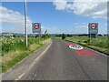
National Cycle Route 77
Heading north east from Errol.
Image: © JThomas
Taken: 12 Jun 2021
0.12 miles
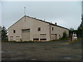
5
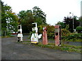
Disused fuel pumps in Errol
The pumps are located beside Image
Image: © Dave Fergusson
Taken: 27 Sep 2010
0.12 miles
6
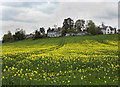
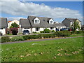
View towards Errol
Housing in the village of Errol, viewed over the fields of New Farm, with oilseed rape coming into flower.
Image: © William Starkey
Taken: 11 May 2013
0.13 miles
7
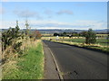
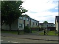
Station Road, Errol
Station Road, heading northwards from Errol.
Image: © Scott Cormie
Taken: 27 Oct 2019
0.14 miles
8
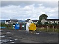
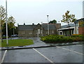
Recycling facility, Errol
Beside the school.
Image: © Richard Webb
Taken: 30 Aug 2014
0.15 miles
9
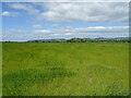
Grassland, Carse of Gowrie
Off National Cycle Route 77 near Errol.
Image: © JThomas
Taken: 12 Jun 2021
0.17 miles