
IMAGES TAKEN NEAR TO
Station Road, PERTH, PH2 7QB
Introduction
This page details the photographs taken nearby to Station Road, PH2 7QB by members of the Geograph project.
The Geograph project started in 2005 with the aim of publishing, organising and preserving representative images for every square kilometre of Great Britain, Ireland and the Isle of Man.

There are currently over 7.5m images from over14,400 individuals and you can help contribute to the project by visiting https://www.geograph.org.uk
Image Map
Images are licensed for reuse under creativecommons.org/licenses/by-sa/2.0
Notes
- Clicking on the map will re-center to the selected point.
- The higher the marker number, the further away the image location is from the centre of the postcode.
Image Listing (42 Images Found)
Images are licensed for reuse under creativecommons.org/licenses/by-sa/2.0
Image
Details
Distance
1
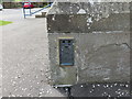
Ordnance Survey Flush Bracket 11535
This bracket can be found on the wall of Errol Primary School. The benchmark's recorded height is 24.708 metres above sea level.
For more detail see : https://www.bench-marks.org.uk/bm12327
Image: © Peter Wood
Taken: 22 Jun 2019
0.02 miles
2
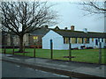
Errol School
Modern extension in the foreground contrasts with the traditional school buildings behind
Image: © James Allan
Taken: 10 Jan 2006
0.03 miles
3
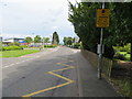
Station Road in Errol
Looking north-eastward from near to Errol Primary School
Image: © Peter Wood
Taken: 22 Jun 2019
0.03 miles
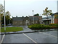
5
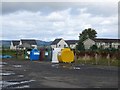
Recycling facility, Errol
Beside the school.
Image: © Richard Webb
Taken: 30 Aug 2014
0.06 miles
6
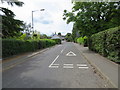
Station Road in Errol
Looking south-westward.
Image: © Peter Wood
Taken: 22 Jun 2019
0.06 miles
8
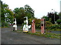
Disused fuel pumps in Errol
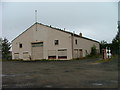
The pumps are located beside Image
Image: © Dave Fergusson
Taken: 27 Sep 2010
0.08 miles
10

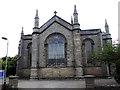
Errol Parish Kirk
The kirk was designed by James Gillespie Graham and built in 1830-1831. See https://portal.historicenvironment.scot/apex/f?p=1505:300:::::VIEWTYPE,VIEWREF:designation,LB11589 for details. It is difficult to appreciate the building as a whole because it is closely surrounded by trees and hemmed in on three sides by other buildings.
Image: © Anne Burgess
Taken: 17 May 2025
0.11 miles