IMAGES TAKEN NEAR TO
Pitroddie, PERTH, PH2 7NU

Introduction

This page details the photographs taken nearby to PH2 7NU by members of the Geograph project.

The Geograph project started in 2005 with the aim of publishing, organising and preserving representative images for every square kilometre of Great Britain, Ireland and the Isle of Man.

There are currently over 7.5m images from over14,400 individuals and you can help contribute to the project by visiting https://www.geograph.org.uk

Image Map


Images are licensed for reuse under creativecommons.org/licenses/by-sa/2.0
Notes
  • Clicking on the map will re-center to the selected point.
  • The higher the marker number, the further away the image location is from the centre of the postcode.

Image Listing (8 Images Found)

Images are licensed for reuse under creativecommons.org/licenses/by-sa/2.0
Image
Details
Distance
1
Road passing Oliverburn
One of the minor roads crossing the Sidlaw Hills.
Image: © Richard Webb Taken: 1 Mar 2024
0.08 miles
2
Stored straw bales
At Oliverburn.
Image: © Dave Fergusson Taken: 27 Sep 2010
0.09 miles
3
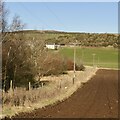
Newly ploughed field, Oliverburn
Goddens in the background.
Image: © Richard Webb Taken: 1 Mar 2024
0.09 miles
4
Minor road at Oliverburn
Looking east.
Image: © Dave Fergusson Taken: 27 Sep 2010
0.09 miles
5
Horses at Oliverburn
A selection of horses in a field near Oliverburn Cottage.
Image: © Scott Cormie Taken: 27 Oct 2019
0.19 miles
6
Unseasonal Whins
This is how you expect a whin bush to look in May, not in November.
Image: © Anne Burgess Taken: 26 Nov 2017
0.20 miles
7
Spring or Autumn?
The beech hedge on the left is in autumn colours, but the whin bush on the right seems to think it's in spring!
Image: © Anne Burgess Taken: 26 Nov 2017
0.20 miles
8
Looking west from Oliverburn
Image: © Dave Fergusson Taken: 27 Sep 2010
0.22 miles