
IMAGES TAKEN NEAR TO
Gladstone Court, Gladstone Terrace, PERTH, PH2 7DZ
Introduction
This page details the photographs taken nearby to Gladstone Court, Gladstone Terrace, PH2 7DZ by members of the Geograph project.
The Geograph project started in 2005 with the aim of publishing, organising and preserving representative images for every square kilometre of Great Britain, Ireland and the Isle of Man.

There are currently over 7.5m images from over14,400 individuals and you can help contribute to the project by visiting https://www.geograph.org.uk
Image Map
Images are licensed for reuse under creativecommons.org/licenses/by-sa/2.0
Notes
- Clicking on the map will re-center to the selected point.
- The higher the marker number, the further away the image location is from the centre of the postcode.
Image Listing (129 Images Found)
Images are licensed for reuse under creativecommons.org/licenses/by-sa/2.0
Image
Details
Distance
2
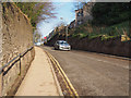
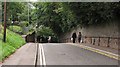
Lochie Brae
This steep narrow road is the main route to Murray Royal Hospital, and one of three roads giving access to the Kinnoull estate housing. Neither of the other two roads are as good as this one. The road infrastructure is a major factor limiting development in this area of Perth.
Note the handrail by the pavement, essential in icy weather.
Image: © Rob Burke
Taken: 17 Feb 2013
0.04 miles
3
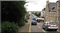
Foot of Lochie Brae
The A93 has to be crossed at the bottom of a steep hill. Perth centre is over the bridge.
Image: © Richard Webb
Taken: 25 Aug 2010
0.04 miles
4
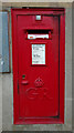
George V postbox on Main Street, Perth
On the former Post Office.
Postbox No. PH2 1.
See Image] for context.
Image: © JThomas
Taken: 12 Jun 2021
0.04 miles
6
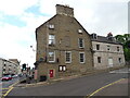
Former Post Office on Main Street, Perth
Showing position of Postbox No. PH2 1.
See Image] for postbox.
Image: © JThomas
Taken: 12 Jun 2021
0.05 miles
7
Hat in the Cat Studio on the corner of West Bridge Street and Main Street, Bridgend
Image: © Alexander P Kapp
Taken: 4 Sep 2012
0.05 miles
9
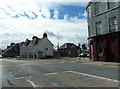
Junction of West Bridge Street, Gowrie Street, and Main street, Perth
Image: © Alexander P Kapp
Taken: 7 Sep 2012
0.06 miles
10
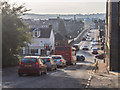
Bridgend crossroads
The view is looking west over Perth Bridge. The road infrastructure here is constrained by the Tay and the slope of Kinnoull Hill. Through traffic from the south (A85) heading to Blairgowrie (A93) or Coupar Angus (A94) combines with local traffic from New Scone and Kinnoull.
The result is queues at busy times, and an air quality problem between the buildings of Main Street (to the right of the photo). Note that this picture was taken at 3:30 pm on a Sunday in February.
Image: © Rob Burke
Taken: 17 Feb 2013
0.06 miles