IMAGES TAKEN NEAR TO
School Gardens, GRANTOWN-ON-SPEY, PH26 3DE

Introduction

This page details the photographs taken nearby to School Gardens, PH26 3DE by members of the Geograph project.

The Geograph project started in 2005 with the aim of publishing, organising and preserving representative images for every square kilometre of Great Britain, Ireland and the Isle of Man.

There are currently over 7.5m images from over14,400 individuals and you can help contribute to the project by visiting https://www.geograph.org.uk

Image Map


Images are licensed for reuse under creativecommons.org/licenses/by-sa/2.0
Notes
  • Clicking on the map will re-center to the selected point.
  • The higher the marker number, the further away the image location is from the centre of the postcode.

Image Listing (45 Images Found)

Images are licensed for reuse under creativecommons.org/licenses/by-sa/2.0
  • ...
Image
Details
Distance
1
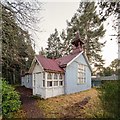
Former Dulnain Church of Scotland Hall
Originally built as a Church of Scotland Mission Station around 1912. Of largely corrugated iron construction, it is in remarkably good condition. The building seems to have been forgotten about as it is neither listed or recorded on Canmore.
Image: © valenta Taken: 12 Jan 2020
0.04 miles
2
Hall, Dulnain Bridge
The mainly corrugated iron building was built by the Church of Scotland in or around 1912. Known as the 'Tin Tabernacle' it remained in use until 1928 when the union took place with the United Free Church and the congregation moved to the current church. It was then used as a church hall.
Image: © Richard Sutcliffe Taken: 20 Oct 2023
0.05 miles
3
Former Dulnain Church of Scotland Hall
Originally built as a Church of Scotland Mission Station around 1912. Of largely corrugated iron construction, it is in remarkably good condition. The building seems to have been forgotten about as it is neither listed or recorded on Canmore.
Image: © valenta Taken: 12 Jan 2020
0.06 miles
4
Leaving Dulnain Bridge
The A938 heading towards the A95.
Image: © Richard Sutcliffe Taken: 20 Oct 2023
0.06 miles
5
Fraser Road, Dulnain Bridge
Image: © Richard Sutcliffe Taken: 20 Oct 2023
0.07 miles
6
Road over the bridge at Dulnain Bridge
This shows the road to the south from its junction with the Carrbridge to Grantown road. The bridge over the River Dulnain starts as the road narrows just after the junction.
Image: © Les Shaw Taken: 28 Jul 2006
0.07 miles
7
River Dulnain
Looking downstream from Dulnain Bridge.
Image: © Richard Sutcliffe Taken: 20 Oct 2023
0.07 miles
8
Woods near Dulnain Bridge
Pond in a boggy section of woodland near Dulnain Bridge. Only a few yards from the road but felt like a million miles away. Reminded me of the "wood between the worlds" of Narnia fame.
Image: © Graham Loveland Taken: 11 Nov 2008
0.08 miles
9
Dulnain Bridge
After which the village is named.
Image: © Richard Sutcliffe Taken: 20 Oct 2023
0.09 miles
10
Dulnain Bridge
Image: © valenta Taken: 12 Jan 2020
0.09 miles
  • ...