IMAGES TAKEN NEAR TO
NETHY BRIDGE, PH25 3DD
Introduction
This page details the photographs taken nearby to PH25 3DD by members of the Geograph project.
The Geograph project started in 2005 with the aim of publishing, organising and preserving representative images for every square kilometre of Great Britain, Ireland and the Isle of Man.

There are currently over 7.5m images from over14,400 individuals and you can help contribute to the project by visiting https://www.geograph.org.uk
Image Map
Images are licensed for reuse under creativecommons.org/licenses/by-sa/2.0
Notes
- Clicking on the map will re-center to the selected point.
- The higher the marker number, the further away the image location is from the centre of the postcode.
Image Listing (10 Images Found)
Images are licensed for reuse under creativecommons.org/licenses/by-sa/2.0
Image
Details
Distance
1
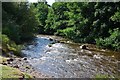
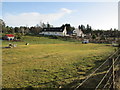
River Nethy
A strong flow down the river after a wet night.
Image: © Jim Barton
Taken: 7 Sep 2013
0.12 miles
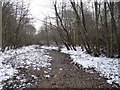
3
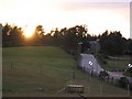
Broomhill Trail at Nethy Bridge
A path between Nethy Bridge and Broomhill, following the River Nethy.
Image: © David Dixon
Taken: 3 Apr 2017
0.20 miles
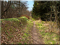
5
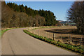
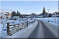
The Road to Broomhill Station
Seen from the edge of Nethy Bridge village.
Image: © Peter Trimming
Taken: 20 Apr 2014
0.23 miles
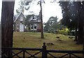
6
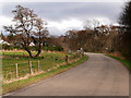
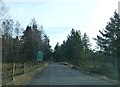
The Road into Nethy Bridge from Broomhill
Image: © David Dixon
Taken: 3 Apr 2017
0.24 miles