
IMAGES TAKEN NEAR TO
AVIEMORE, PH22 1QD
Introduction
This page details the photographs taken nearby to PH22 1QD by members of the Geograph project.
The Geograph project started in 2005 with the aim of publishing, organising and preserving representative images for every square kilometre of Great Britain, Ireland and the Isle of Man.

There are currently over 7.5m images from over14,400 individuals and you can help contribute to the project by visiting https://www.geograph.org.uk
Image Map
Images are licensed for reuse under creativecommons.org/licenses/by-sa/2.0
Notes
- Clicking on the map will re-center to the selected point.
- The higher the marker number, the further away the image location is from the centre of the postcode.
Image Listing (13 Images Found)
Images are licensed for reuse under creativecommons.org/licenses/by-sa/2.0
Image
Details
Distance
1
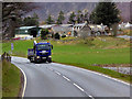
Granish Farm
Jewson MAN HGV (DG16 EKZ) passes Granish Farm on the B9152 (previously the main A9 route and before that, Genaral Wade's Military Road) near Aviemore.
Image: © David Dixon
Taken: 7 Apr 2017
0.02 miles

3
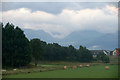
View to the Lairig Ghru from just north of Aviemore
Cloud hangs in the valley of the Lairig Ghru.
Image: © Mike Pennington
Taken: 25 Jul 2013
0.08 miles
4
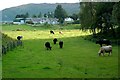
Farmland Near Aviemore
Cattle grazing at Sluggangranish, to the north of Aviemore.
Image: © Mary and Angus Hogg
Taken: 20 Aug 2011
0.11 miles
5
Northern outskirts of Aviemore at Dalfaber
Image: © Alan Reid
Taken: 31 Mar 2017
0.13 miles
6
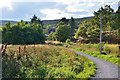
Footpath near Aviemore
A path round the outer suburbs of Aviemore, approaching the B9152 and on the route of the Speyside Way.
Image: © Jim Barton
Taken: 7 Sep 2013
0.14 miles
7
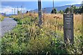
The Aviemore Orbital Path
I don't know if it's possible to make a complete orbit of Aviemore on foot, but this path keeps the pedestrian away from the road until the final stretch into the town centre, and is on the route of the Speyside Way.
Image: © Jim Barton
Taken: 7 Sep 2013
0.15 miles
8
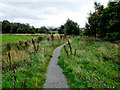
Aviemore Orbital Path
The path here is shared by the Speyside Way.
Image: © John Allan
Taken: 8 Sep 2016
0.17 miles
9
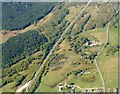
A9
The straight route of the new A9 on the left makes a contrast with its predecessor on the right, just north of Aviemore.
Image: © Anne Burgess
Taken: 14 May 2005
0.18 miles
10
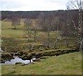
Scattered birch at the north edge of Aviemore
Image: © Alan Reid
Taken: 31 Mar 2017
0.18 miles