IMAGES TAKEN NEAR TO
AVIEMORE, PH22 1PZ
Introduction
This page details the photographs taken nearby to PH22 1PZ by members of the Geograph project.
The Geograph project started in 2005 with the aim of publishing, organising and preserving representative images for every square kilometre of Great Britain, Ireland and the Isle of Man.

There are currently over 7.5m images from over14,400 individuals and you can help contribute to the project by visiting https://www.geograph.org.uk
Image Map
Images are licensed for reuse under creativecommons.org/licenses/by-sa/2.0
Notes
- Clicking on the map will re-center to the selected point.
- The higher the marker number, the further away the image location is from the centre of the postcode.
Image Listing (23 Images Found)
Images are licensed for reuse under creativecommons.org/licenses/by-sa/2.0
Image
Details
Distance
2
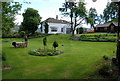
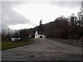
Lynwilg House
The Wooden building on the right used to be for self catering. Lynwilg House has extensive grounds running up the side of the Allt na Criche.
Image: © jeff collins
Taken: 30 May 2011
0.05 miles
3
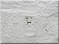
Ordnance Survey Flush Bracket G1205
The bracket can be found on the wall of Kinrara Distillery at Lynwilg.
This benchmark has a recorded height of 228.805 metres above sea level.
For more detail see : https://www.bench-marks.org.uk/bm18092
Image: © Peter Wood
Taken: 22 Sep 2020
0.08 miles
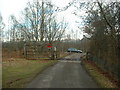
4
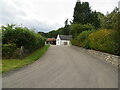
Access road to Kinrara Distillery at Lynwilg
Looking south-westward.
Image: © Peter Wood
Taken: 22 Sep 2020
0.08 miles
7
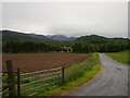
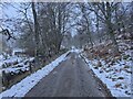
Road and farmland at Lynwilg
View of the minor road that leads to Lynwilg together with the surrounding farmland
Image: © Jonathan Venn
Taken: 11 Jun 2011
0.14 miles
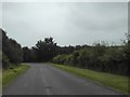
9
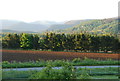
Part of a field ready for sowing
This field is squeezed between the small road to Lynwilg House and farm and the busy A9 just visible through the trees in the centre ground.
Image: © jeff collins
Taken: 31 May 2011
0.14 miles
10
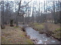
Allt-na-Criche
The river near Lynwilg.
Image: © David Medcalf
Taken: 2 Mar 2007
0.16 miles