IMAGES TAKEN NEAR TO
KINGUSSIE, PH21 1LS

Introduction

This page details the photographs taken nearby to PH21 1LS by members of the Geograph project.

The Geograph project started in 2005 with the aim of publishing, organising and preserving representative images for every square kilometre of Great Britain, Ireland and the Isle of Man.

There are currently over 7.5m images from over14,400 individuals and you can help contribute to the project by visiting https://www.geograph.org.uk

Image Map


Images are licensed for reuse under creativecommons.org/licenses/by-sa/2.0
Notes
  • Clicking on the map will re-center to the selected point.
  • The higher the marker number, the further away the image location is from the centre of the postcode.

Image Listing (23 Images Found)

Images are licensed for reuse under creativecommons.org/licenses/by-sa/2.0
  • ...
Image
Details
Distance
1
Laggan Cottage in snow
Image: © Peter Bond Taken: 4 Feb 2009
0.01 miles
2
Laggan Cottage
Image: © Peter Bond Taken: 2 Feb 2009
0.02 miles
3
Laggan Cottage near Kingussie
I was staying here at the time. It was like being in a Xmas Card.
Image: © Peter Bond Taken: 4 Feb 2009
0.03 miles
4
B9152 in snowy conditions
Image: © Peter Bond Taken: 4 Feb 2009
0.06 miles
5
B9152 east of Kingussie
Image: © Peter Bond Taken: 4 Feb 2009
0.07 miles
6
Private level crossing near Lynchat
Image: © Steven Brown Taken: 21 Nov 2010
0.10 miles
7
A cairn on the northeast side of Kingussie
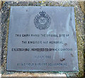
This cairn on an elevated position at Tom Cheireag is 1.2m wide at the base and 1.5 metres high. It marks the original site of the Kingussie War Memorial erected in 1921 and relocated to Gynack Gardens in 1952. For a view of the war memorial, see Image For a view of the inscribed plaque, see Image
Image: © Walter Baxter Taken: 8 Mar 2014
0.11 miles
8
A plaque on a Kingussie cairn
For a view of the cairn marking the former location of Kingussie War Memorial, see Image
Image: © Walter Baxter Taken: 8 Mar 2014
0.11 miles
9
B9152 (old A9) near Kingussie Cemetery
Image: © J M Briscoe Taken: 1 Jun 2005
0.11 miles
10
East along the Spey valley
Kerrow is in the foreground.
Image: © Stephen Stachowiak Taken: 26 Aug 2010
0.12 miles
  • ...