IMAGES TAKEN NEAR TO
Kinloch Rannoch, PITLOCHRY, PH16 5QB

Introduction

This page details the photographs taken nearby to PH16 5QB by members of the Geograph project.

The Geograph project started in 2005 with the aim of publishing, organising and preserving representative images for every square kilometre of Great Britain, Ireland and the Isle of Man.

There are currently over 7.5m images from over14,400 individuals and you can help contribute to the project by visiting https://www.geograph.org.uk

Image Map


Images are licensed for reuse under creativecommons.org/licenses/by-sa/2.0
Notes
  • Clicking on the map will re-center to the selected point.
  • The higher the marker number, the further away the image location is from the centre of the postcode.

Image Listing (11 Images Found)

Images are licensed for reuse under creativecommons.org/licenses/by-sa/2.0
Image
Details
Distance
1
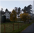
Bunrannoch House, Kinloch Rannoch
Image: © Ian S Taken: 21 Oct 2014
0.07 miles
2
Road near to Bunrannoch
Looking south-westward.
Image: © Peter Wood Taken: 28 Apr 2019
0.12 miles
3
Minor road to Bunrannoch House and south shore of loch
Image: © Peter Bond Taken: 30 Sep 2011
0.13 miles
4
Below Creag an Fhithich
Sheep on flat ground with steep birch woods on the slopes of Creag an Fhithich. The flat land here suggests that Loch Rannoch may have once been larger, and has either drained a little or been filled in. Some of the putative former loch is underwater again as Dunalastair Water.
Image: © Richard Webb Taken: 25 May 2008
0.14 miles
5
Bunrannoch
The land here is a village site according to the 1:25000 mapping. Woods on the lower slopes of Creag an Fhithich beyond.
Image: © Richard Webb Taken: 25 May 2008
0.14 miles
6
Collapsed bales
At the south east corner of the Kinloch Rannoch triangle.
Image: © Callum Black Taken: 14 Apr 2006
0.16 miles
7
JCB
Ditch digging.
Image: © Callum Black Taken: 14 Apr 2006
0.17 miles
8
No stopping, no parking!
A most odd sign to see on a rural back road in highland Perthshire. Almost the whole distance along the Schiehallion road from the edge of Kinloch Rannoch to the junction with B846 as it heads south over the hills to Aberfeldy is now a clearway. This seemingly draconian rule has been introduced due to irresponsible parking along the roadside particularly by those setting off to climb Schiehallion. The photographer passed by the official Schiehallion car park several times during an October week and found it full to overflowing on each occasion. The narrow road along the south side of Loch Tummel has a similar restriction.
Image: © Gordon Hatton Taken: 11 Oct 2020
0.17 miles
9
Woodland, Creag an Fhithich
Deep snow on a mix of woodland and fields by Kinloch Rannoch.
Image: © Richard Webb Taken: 28 Feb 2010
0.20 miles
10
Minor road west of Bunrannoch House
Two roads leave the south side of the village of Kinloch Rannoch, one to the south-east, the other to the south-west; this minor road connects them. Larch trees on the north side of the road are showing autumnal colour.
Image: © Trevor Littlewood Taken: 22 Oct 2012
0.21 miles