IMAGES TAKEN NEAR TO
PITLOCHRY, PH16 5NP
Introduction
This page details the photographs taken nearby to PH16 5NP by members of the Geograph project.
The Geograph project started in 2005 with the aim of publishing, organising and preserving representative images for every square kilometre of Great Britain, Ireland and the Isle of Man.

There are currently over 7.5m images from over14,400 individuals and you can help contribute to the project by visiting https://www.geograph.org.uk
Image Map
Images are licensed for reuse under creativecommons.org/licenses/by-sa/2.0
Notes
- Clicking on the map will re-center to the selected point.
- The higher the marker number, the further away the image location is from the centre of the postcode.
Image Listing (10 Images Found)
Images are licensed for reuse under creativecommons.org/licenses/by-sa/2.0
Image
Details
Distance
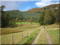
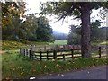
1
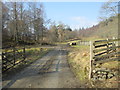
Bonskeid Home Farm west of Killiecrankie
The farm peeps above a field.
Image: © nick macneill
Taken: 8 Sep 2011
0.02 miles
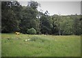
5
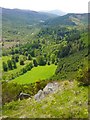
Creag na h-Airigh and the Tummel Valley
Image: © Alisdair MacDonald
Taken: Unknown
0.13 miles
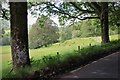
7
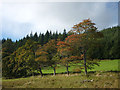
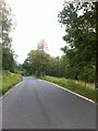
Roadside trees near Bonskeid Home Farm
The autumn colours are just starting to come through - it's a shame we couldn't be here on holiday a couple of weeks later.
Image: © Karl and Ali
Taken: 21 Sep 2012
0.15 miles