IMAGES TAKEN NEAR TO
PITLOCHRY, PH16 5NF

Introduction

This page details the photographs taken nearby to PH16 5NF by members of the Geograph project.

The Geograph project started in 2005 with the aim of publishing, organising and preserving representative images for every square kilometre of Great Britain, Ireland and the Isle of Man.

There are currently over 7.5m images from over14,400 individuals and you can help contribute to the project by visiting https://www.geograph.org.uk

Image Map


Images are licensed for reuse under creativecommons.org/licenses/by-sa/2.0
Notes
  • Clicking on the map will re-center to the selected point.
  • The higher the marker number, the further away the image location is from the centre of the postcode.

Image Listing (50 Images Found)

Images are licensed for reuse under creativecommons.org/licenses/by-sa/2.0
  • ...
Image
Details
Distance
1
Wester Clunie
Image: © N Chadwick Taken: 14 Aug 2021
0.01 miles
2
Wester Clunie
Image: © N Chadwick Taken: 14 Aug 2021
0.02 miles
3
Entrance to Clunie Power Station
Image: © Iain Macaulay Taken: 28 Nov 2005
0.03 miles
4
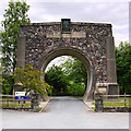
Memorial arch, Clunie Power Station
The imaginative entrance arch (completed 1951) is a replica of the cross-section of the pressure tunnel that connects the supply from Loch Tummel to the power station. The left-hand plaque lists the members of the North of Scotland Hydro-Electric Board chaired by Thomas Johnston; that on the right commemorates five men who died building the tunnel in 1948-49.
Image: © Jim Barton Taken: 22 Nov 2019
0.04 miles
5
Clunie Memorial Arch
Erected to the memory of the five men who lost their lives in the construction of the Clunie tunnel, part of the Tummel hydro-electric scheme.
Image: © Rod Allday Taken: 8 Apr 2012
0.04 miles
6
Clunie Memorial Arch
Category B
Image: © N Chadwick Taken: 14 Aug 2021
0.04 miles
7
Memorial Arch, Clunie Power Station
Showing the actual size of the water tunnel at the Clunie HEP Station. The memorial was built 1951 in memory of men who lost their lives during the construction work.
Image: © Colin Smith Taken: Unknown
0.04 miles
8
The Clunie Arch
This arched entrance was built as a memorial to the men who died while building the tunnel to feed Clunie Power Station in the late 1940s. The arch measures 6.9 metres across - the same diameter as the tunnel. This remains one of the largest water tunnels in the UK.
Image: © Gordon Brown Taken: 8 Aug 2024
0.05 miles
9
Clunie Arch
Archway constructed at the entrance to Clunie Hydro Power Station to commemorate workers who died during tunnelling works in the 1940s & '50s.
Image: © Gordon Hatton Taken: 30 Mar 2009
0.06 miles
10
Clunie Arch
Built in 1951, this straddles the approach road to Clunie power station and is an actual size cross-section of the 22 foot 6 inch horseshoe shaped Clunie Tunnel, which brings water 2 miles from Clunie Dam to the power station. This was the largest water-carrying tunnel in Britain at the time. The Arch also serves as a memorial to tunnellers who died in a freak accident during the driving of the tunnel: A charge at the working face was exploded prematurely by lightning striking the hillside above.
Image: © Dr Richard Murray Taken: 25 Jun 2010
0.06 miles
  • ...