IMAGES TAKEN NEAR TO
PITLOCHRY, PH16 5NE
Introduction
This page details the photographs taken nearby to PH16 5NE by members of the Geograph project.
The Geograph project started in 2005 with the aim of publishing, organising and preserving representative images for every square kilometre of Great Britain, Ireland and the Isle of Man.

There are currently over 7.5m images from over14,400 individuals and you can help contribute to the project by visiting https://www.geograph.org.uk
Image Map
Images are licensed for reuse under creativecommons.org/licenses/by-sa/2.0
Notes
- Clicking on the map will re-center to the selected point.
- The higher the marker number, the further away the image location is from the centre of the postcode.
Image Listing (53 Images Found)
Images are licensed for reuse under creativecommons.org/licenses/by-sa/2.0
Image
Details
Distance
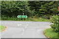
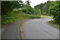
3
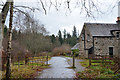
Old road, Balmore
The old road is now a cycle and pedestrian route to the Pitlochry dam.
Image: © Jim Barton
Taken: 22 Nov 2019
0.02 miles
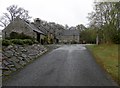
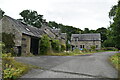
4
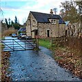
Balmore Cottages
Now very close to Pitlochry By-pass
Image: © Jim Smillie
Taken: 20 Nov 2021
0.02 miles
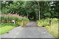
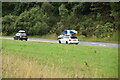
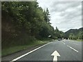
7
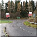
Approaching Pitlochry By-pass
There is a 50mph limit for trucks on single carriageway sections
Image: © Jim Smillie
Taken: 20 Nov 2021
0.05 miles